February 7, 2022
As we move into the final month of meteorological winter, outlooks for February continue to show a classic La Niña (LN) signature across the United States. On the temperature side, above-average probabilities for warmer temperatures are found across the East Coast and throughout much of the Sun Belt States. Elevated chances of colder than average temperatures are located over Minnesota, much of the Dakotas and into the Pacific Northwest. Iowa happens to be in the middle of the configuration and hence, has Equal Chances (EC) of being above/below/near-average (Figure 1). The LN pattern is also evident in the precipitation outlooks with elevated chances of wetter conditions in the Ohio Valley and Great Lakes and through the upper Midwest. Again, most of Iowa is classified as “EC” (Figure 2).
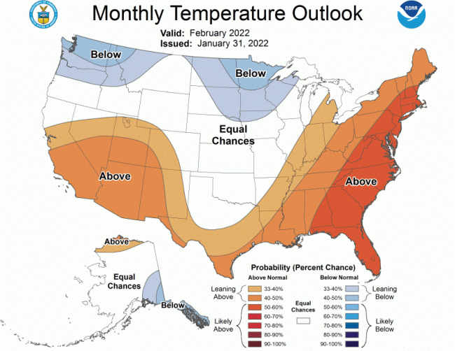
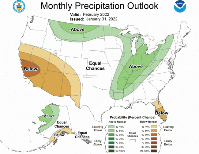
Shorter-term outlooks into the middle of February suggest a transition to higher probabilities of unseasonably warm temperatures with a persisting dry signal. Analog years for weak LN winters since 1950 suggest above-average snowfall for Iowa and the Upper Midwest. As of early February, much of Iowa is experiencing below-normal snowfall with only southeastern Iowa receiving above-average accumulations; Iowa’s western third has snowfall deficits on the order of six to 12 inches with four to eight-inch deficits for the rest of the state. Most of Minnesota, North Dakota and northern Wisconsin are showing above-normal totals, which could have implications for spring flood potential in the Mississippi basins.
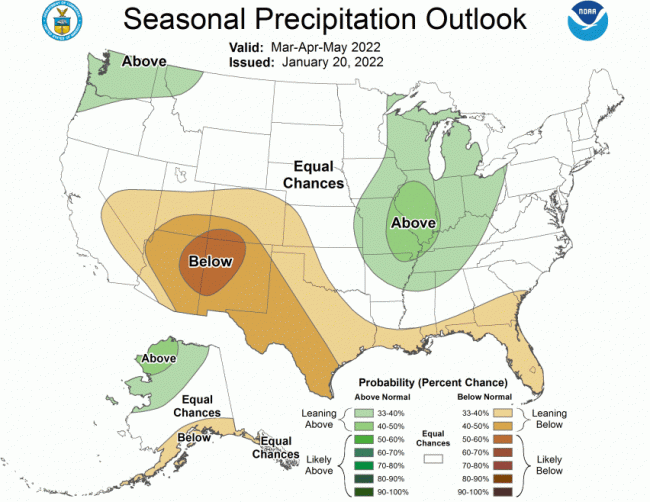
Seasonal outlooks for February-March-April show a similar pattern to February with a westward shift of slightly elevated chances of wetter conditions over Iowa’s eastern half and EC for temperature behavior. Shifting the seasonal outlooks by one month to March-April-May suggests a comparable setup for precipitation (Figure 3) with a northward shift of slightly elevated chances of warmer temperatures across the southern quarter of Iowa. These seasonal outlooks are underpinned with a persisting weak LN phase forecasted to continue through May 2022 with a 51% chance of transitioning back to ENSO-neutral.
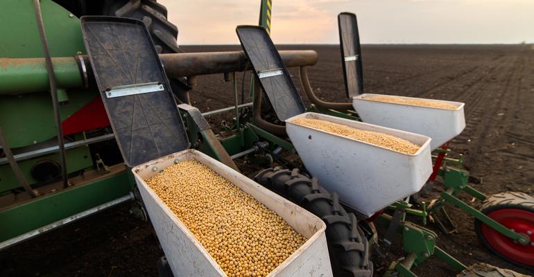
Currently these outlooks combined with drier soils over most of the state do not indicate any spring field work issues at this time. With these outlooks, slightly drier soils may be the more likely scenario than wet soils. The increased precipitation chances for eastern Iowa are quite small at this point.
Source: Iowa State University, which is solely responsible for the information provided and is wholly owned by the source. Informa Business Media and all its subsidiaries are not responsible for any of the content contained in this information asset.
Read more about:
WeatherYou May Also Like


