Subscribe to receive top agriculture news
Be informed daily with these free e-newsletters

Parts of Louisiana, Arkansas and eastern Texas have an elevated risk of moderate flooding, along with communities along the Mississippi and Missouri River basins and the southeastern United States, from Alabama to North Carolina. Surrounding areas are at risk of minor flooding this spring.
March 18, 2016
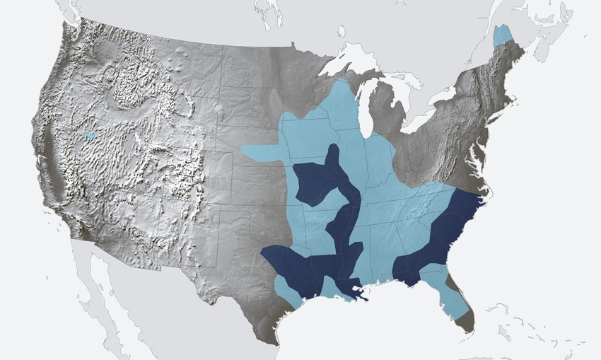
According to NOAA’s U.S. Spring Outlook released March 16 areas of the country still under water from torrential rainfall last week have an elevated risk of moderate flooding through the rest of the season.
Parts of Louisiana, Arkansas and eastern Texas have an elevated risk of moderate flooding, along with communities along the Mississippi and Missouri River basins and the southeastern United States, from Alabama to North Carolina. Surrounding areas are at risk of minor flooding this spring.
For April through June, the U.S. Spring Outlook favors above-average precipitation across western Alaska, and the southern half of the country including most of California, the Southwest, the Gulf Coast and the Southeast. Below-average precipitation is favored around the Great Lakes, parts of the Pacific Northwest, the southern Alaska Panhandle and Hawaii. Most of the country, except the Central and Southern Plains, is favored to see above-average temperatures from April through June.
NOAA hydrologists determine the spring flood risk based on environmental intelligence collected across the country, including late summer and fall precipitation, frost depth, soil saturation levels, stream flows, snowpack, temperatures and rate of snowmelt. This national assessment is a compilation of local threats evaluated by the National Weather Service’s 122 weather forecast offices and 13 river forecast centers. Contributing to the risk of flooding this spring, December 2015 was the wettest December on record for the contiguous United States, according to NOAA climate data.
“Our assessment of spring flood risk is based in large part on saturated soils and elevated streamflows from the Gulf Coast northward along the Mississippi River, although heavy rainfall at any time can cause local or regional flooding, even in places where the risk is currently considered low,” said Tom Graziano, Ph.D., acting director of NOAA’s National Water Center. “We encourage people to be prepared for the range of spring weather threats, including flooding, and tune into local forecasts to monitor their personal risk.”
You May Also Like
Enter a zip code to see the weather conditions for a different location.


