

Subscribe to receive top agriculture news
Be informed daily with these free e-newsletters

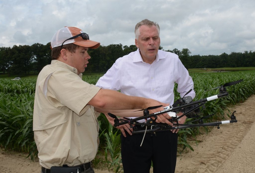
At this year’s Virginia Ag Expo Aug. 4 at Billy Bain’s Double B Farm in Dinwiddie, Balota and Oakes demonstrated the technology to attendees, including Virginia Gov. Terry McAuliffe who was on hand to learn more about agricultural research.
Maria Balota and Joseph Oakes give the drone high marks for results and accuracy.
Balota, associate professor of crop physiology at the Virginia Tech Tidewater Research and Extension Center in Suffolk, and Oakes, postdoctoral research associate in Balota’s program, began using the drone last year to measure NDVI (normalized difference vegetation index) for nitrogen fertility rates in wheat at both the Tidewater center and the Eastern Virginia Agricultural Research and Extension Center in Warsaw in Virginia’s Coastal Plain.
At this year’s Virginia Ag Expo Aug. 4 at Billy Bain’s Double B Farm in Dinwiddie, Balota and Oakes demonstrated the technology to attendees, including Virginia Gov. Terry McAuliffe, who was on hand to learn more about agricultural research in the Commonwealth.
The governor asked Oakes how much the technology cost and Oakes explained the entire package, including the Ascending Technologies (AscTec) Falcon 8 Octocopter and three different sensors, an infrared sensor, a near-infrared multispectral camera and a digital camera, costs $50,000.
This year, Oakes and Balota began using the drone to measure plant populations in peanuts in addition to a wheat study at Suffolk and Warsaw in collaboration with wheat breeder Carl Griffey and his graduate student, Kyle Brasier. So far, the scientists are pleased with the results of the drone in their research and the data delivered.
Balota requested funding for this acquisition and was granted money from the Virginia Peanut Board, Virginia Peanut Association (shellers), and Virginia Crop Improvement Association, all long time supporters of Balota’s research program.
Oakes said the drone attached with a Tetracam near-infrared multi-spectral camera provided better results in the measurement of NDVI in wheat than the more commonly used hand held green seeker device. “It takes quite awhile to measure NDVI in a whole field with a hand held green seeker, but with a drone you can measure NDVI in 10 to 15 minutes and you’re done. We are getting better data with the drone,” he said.
Oakes and Balota plan to use the data gathered from the drone to make prescription map software that farmers can plug directly into their tractors to determine the right nitrogen application for their wheat.
“The drone does a good job in providing us photos of how green the wheat crop actually is,” Oakes said. “It provides a better correlation with yield than ground measured NDVI. Nitrogen rates can be calculated from NDVI for tractor/sprayer software to read and apply.”
Results with the drone also show promise in Virginia Tech’s peanut research this year. Balota explains that the drone is being used to estimate drought stress and yield in peanuts grown under rainout shelters at the Tidewater Center. As in wheat, researchers are comparing data taken from the drone to ground taken NDVI to measure peanut plant populations.
“We are using the drone in our seeding rate experiment to determine if farmers can plant peanuts at a lower seeding rate without a yield penalty. We are using the drone to estimate crop establishment. We are just developing the methodology right now, but so far the results are encouraging,” Balota explained.
In the research, Balota and Oakes uses three different types of cameras on the drone, a regular digital camera, an infra-red FLIR, and a near-infrared multispectral camera. The digital camera is used to measure the percentage of green pixels in the peanut and wheat plots, which is a good way to actually determine plant population, Oakes said.
“The drone works very well in helping us determine plant populations. It really shows when plant populations are low in certain areas,” he said.
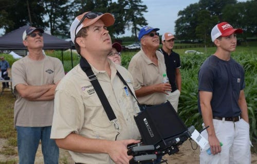
Virginia Ag Expo attendees look to the sky as Joseph Oakes, postdoctoral research associate at the Tidewater Research and Extension Center, flies the AscTec Falcon 8 Octocopter drone over a peanut field at Double B Farms in Dinwiddie, Va.
Virginia Ag Expo attendees look to the sky as Joseph Oakes, postdoctoral research associate at the Tidewater Research and Extension Center, flies the AscTec Falcon 8 Octocopter drone over a peanut field at Double B Farms in Dinwiddie, Va.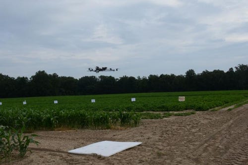
The drone is airborne, taking photos of the peanut field below.
The drone is airborne, taking photos of the peanut field below.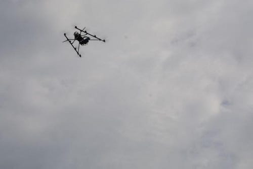
Virginia Tech is using the AscTec Falcon 8 Octocopter drone in peanut and wheat research this year.
Virginia Tech is using the AscTec Falcon 8 Octocopter drone in peanut and wheat research this year.You May Also Like
Enter a zip code to see the weather conditions for a different location.


