Subscribe to receive top agriculture news
Be informed daily with these free e-newsletters

Company is getting into the unmanned aerial vehicle business
August 5, 2015
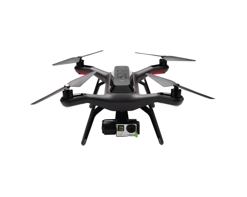
Agco's latest piece of equipment can travel at a top speed of 55 mph and it never touches the ground. The company is launching the Solo Agco Edition unmanned aerial vehicle during the fall farm show season. The system will offer what the company calls "intuitive mission planning and cloud-based, high-resolution mapping software."
The Solo Agco Edition UAV offers operators hardware, software, service and support in one package. The unit can fly in winds up to 25 mph and can reach a top speed of 55 mph. When fully charged, the unit's smart battery is capable of covering up to 60 acres, depending on conditions and user-defined settings. Average flight time for the UAV is 20 minutes, fully equipped. The kit includes four batteries, so you could scout 240 acres in a single series of flights.
In a media release, Jeff Punter, manager, purchasing Agco Parts, notes that the company "thought of everything a farmer needs to not only scout their fields, but also collect useful data beneficial to managing their farm and improving yields and efficiency."
The UAV is built on 3D Robotics Solo platform. It uses a three-axis Solo Gimbal, accessory bay and swappable motor pods, allowing easy integration of future technology and features.
Related: FAA approves more than 1,000 exemptions for UAV use
The machine includes simple mission planning and can run fully autonomous flights. It is equipped with auto take-off and landing, and an emergency air brake and return-to-home features. The product includes in-app training and configurable settings in order to accommodate different operator skill levels.
The Solo Agco Edition UAV includes two cameras customized for aerial imaging - an RGB camera for color imaging and a near-infrared camera for monitoring photosynthetic activity, or plant health. The cameras are paired with an included one-year of Agribotix imaging software to produce high resolution Orthomosaics, Normalized Difference Vegetation Index and Field Health and Management Zone maps for better insight to what's going on in your fields.
Image processing history, maintained in the cloud, allows for comprehensive field condition comparison, making it easier to have precise placement of fertilization and irrigation resulting in improved yields. Live flight data – including the battery life, altitude and distance from home – are all streamed to the operator's controller for real-time flight control.
You can check out the new UAV at the 2015 Farm Progress Show Sept. 1-3 in Decatur, Ill.
You May Also Like
Current Conditions for
48°F
Mostly Cloudy
Day 51º
Night 36º
Enter a zip code to see the weather conditions for a different location.


