Subscribe to receive top agriculture news
Be informed daily with these free e-newsletters
August 16, 2014
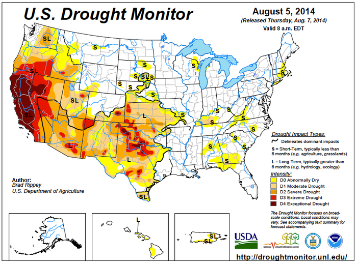
Much-needed rain fell across the southern and western Corn Belt, easing concerns about the effects of a drier-than-normal July on reproductive to filling summer crops. Weekly rainfall totaled 2-4 inches or more from the central Plains into the middle Mississippi Valley, but pockets of short-term dryness persisted in the northern and eastern Corn Belt.
Significant and highly beneficial rainfall also spread through the Tennessee Valley into the Carolinas, but unfavorably dry conditions persisted across the lower Southeast – excluding southern Florida. Drought-related concerns also returned to Texas, due to mostly dry weather and building heat. Most other areas of the Plains received some rain, with the highest amounts (1-3 inches or more) occurring from northern Oklahoma to southern and eastern South Dakota. Warm, generally dry weather persisted, however, in Montana, favoring winter wheat harvesting and spring wheat maturation.

Get more weather information and maps
Did you know you can get weather information on csdigest.com? We’ve got current weather, forecasts, radar and ag weather maps right here!
Meanwhile, Northwestern heat and dryness promoted fieldwork but maintained stress on rangeland, pastures, and rain-fed summer crops. Elsewhere, locally heavy monsoon showers dotted the Great Basin, Intermountain West, and Southwest—even California—causing flash flooding but providing local drought relief.
All graphics courtesy of USDA, NOAA, Department of Commerce
You May Also Like
Enter a zip code to see the weather conditions for a different location.