
Subscribe to receive top agriculture news
Be informed daily with these free e-newsletters
In recent years, irrigation technology has made incredible strides. If Trenton Franz’ vision bears fruit, precise irrigation prescriptions may be just around the corner.
The device Franz uses to measure soil moisture is a set of three-foot-long, four-inch tubes. Inside the tubes is some plastic and boron trifluoride gas. There’s also a cathode and anode.
“It is kind of Star Wars-esque,” says the hydrogeophysicist with the University of Nebraska-Lincoln. “But it’s actually a standard device in physics used to measure neutrons. Actually, farmers and agronomists have been using neutron measurements since the 1940s.”
Where the Franz technology differs is “we use the sun and other exploding stars – supernovas – for a source and essentially measure the back-scatter of neutrons from the soil. The device sits above the soil surface so it can also count neutrons in the air. Those neutrons mix over a very large area. So, we get an average measurement over the top foot-and-a-half of soil over a 1,000-foot radius circle.”
All the tubes are connected to a data logger that writes the neutron counts to an SD card in real time. “We take the text file and run it through some algorithms I’ve developed to turn the data into soil moisture information. My hope is these maps allow farmers to optimize water management in each of their fields.”
Do you have any experience in agriculture?
“I grew up in Colorado and have a lot of family members in the eastern part of the state who have operations. But I haven’t had too much experience with that.
“My degrees are in civil and environmental engineering. Since joining the University of Nebraska two years ago, I’ve focused on the agriculture sector.”
Is the device pulled behind a tractor? Mounted on something?
“We have two types of these made by Hydroinnova. They weigh about 200 pounds because we need a series of the three-foot long four-inch tubes. The dimensions are around 3.5-feet by five feet.
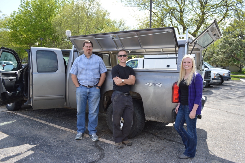
“We have one in the bed of a pickup truck. The other one is on a side-by-side Kawasaki mule. That allows us to go over 30-inch rows so we can do maps over the crop.
“You can mount one of these to your existing equipment and do a moisture map while you’re doing spray applications or other things. Next year, we’ll probably put one on a sprayer or a de-tasseler, which is used to cut off males in seed corn. Those are a bit taller than a sprayer.
“I put together an algorithm that, when you drive over sprayer tracks, the series of equations and other calculations will provide a map of the field. It’s kind of like a CAT scan for your field. A CAT scan works by a bunch of magnets moving around while pictures are taken. Someone had to figure out how to put those images together to produce a model. We’re doing that with neutrons – putting data together to form a complete product.”
How did you come to this research?
“I was hired here with two cropping specialists and a variable rate irrigation specialist. In learning more about the irrigation technology, our monitoring practices are far behind what we can do to actually apply water. The idea was ‘hey, we’ve got all these nice geo-physical tools. How can we apply them to these monitoring problems?’ That’s the genesis.
“We make a measurement every minute. How fast you can drive across the field depends on what resolution you want. If you’re doing variable speed, two degree pie slices you don’t need as many data points because you’re going with a much bigger area. If you want variable rate, high resolution maps it takes longer.
“We’ve been mapping six fields for various producers around the state. It typically takes us about an hour, or 90 minutes for a lower-resolution map. For a high-resolution map it takes about three hours. It takes a minute, or two, to process the data before you’ll have a map at your fingertips.
“We’re working on ways to take the data and spit it out into a variety of products. SMS is used by a lot of folks to do prescription maps. We’re at the point where we want to make the data more digestible and usable and cost-effective for the broader agriculture community.”
Could it be mounted on a center-pivot?
“We’ve done that but it doesn’t provide the number of data points needed. It’s better to just go out and make a map. If you have a dedicated piece of equipment – like our side-by-side – it’s more cost-effective because you can cover a much larger area.”
How might this work with future irrigation technology?
“We’ve thought a lot about that. It turns out you don’t need that many maps to understand the spacial patterns in your field. A producer kind of knows where there’s sandy versus heavier textured soils. This provides more confirmation of how your field responds, more hard data.
“So, you might use it two or three times a year and make a spacial map either before or after you apply water. That would give you a lot of information on how your field ‘works’ with water. Those two or three maps would become very cost effective because you could potentially monitor hundreds of fields with a single instrument.”
Are you working with agronomists to come up with best management practices in conjunction with this?
“Yes, that’s the next step. What are the right niches for this technology?
“As it measures the top two feet, what are the best cropping strategies? Most of the cropping action happens in the top two feet. That’s especially true for potatoes or vegetable crops.”
Other potential use for this?
“This actually came from the academic world looking at weather forecasting. Those forecasts are really dependent on how much water is currently in the soil because that essentially feeds the energy balance. So, there’s consideration for setting up monitoring networks across the world to feed into weather forecasting models.
“Another application is military related. The Army Corps of Engineers is interested in mobility mapping – soil strength in real time. They’d be able to go out and drive this instrument in front of the work equipment. Then they could calculate what machinery and how fast it could move across the soil.”
So, the military could see if a tank would get bogged down if it drives a certain route?
“Exactly. You don’t want to get stuck in the mud – especially if you’re in a hostile environment.”
You May Also Like
Enter a zip code to see the weather conditions for a different location.


