May 9, 2022

Use of fungicides in corn and soybeans has grown in the past decade across the country; however, questions on how to properly use them still exist. A partnership between a tech startup and a central Illinois cooperative aims to make these crop protection tools easier to use.
“For a lot of growers, deciding whether they should spray a fungicide or when they should spray is a challenging decision for them,” says Kirk Stueve, product scientist for Ceres Imaging.
Ceres Imaging and the Evergreen FS co-op are partnering to provide the Ceres Field Disease Risk product.
“During the growing season, in some years it doesn’t pay to spray fungicides, yet it pays in other years,” Stueve says.
And timing is an issue, spray too early or too late, and farmers don’t get the desired results. In 2021, Ceres Imaging and Evergreen FS tested this collaboration on 100,000 acres.
Ceres Imaging, long known for its use of artificial intelligence linked to field imagery, will bring that data to the Agtrinsic platform, which is a network used by Evergreen FS. The Agtrinsic platform uses weather data, artificial intelligence and other tools to determine if there is rising risk of disease pressure. Adding in Ceres capability to that initial information can help bring precision to fungicide use.
“And most farmers apply fungicide across a whole field,” Stueve says.
He notes Ceres will add the capability to apply fungicide more precisely, by targeting disease areas and offering a prescription map. The idea is not to cut fungicide rates, but to put fungicide where it will be the most effective.
System at work
The Field Disease Risk product uses Ceres Imaging AI capabilities to look at crops and determine where disease may be most likely. The idea is to get ahead of the disease risk and allow the farmer time to pull the trigger on precision fungicide use.
Here’s how it will work:
Monitoring. Agtrinsic monitors for regional disease risk through its network, including weather and crop conditions.
Flagging. When Agtrinsic flags a region as high risk for disease pressure through AI technology, that triggers a field-level analysis by Ceres imaging.
Assessing. Using satellite data combined with patented algorithms, Ceres can assess disease risk at a farm and field level.
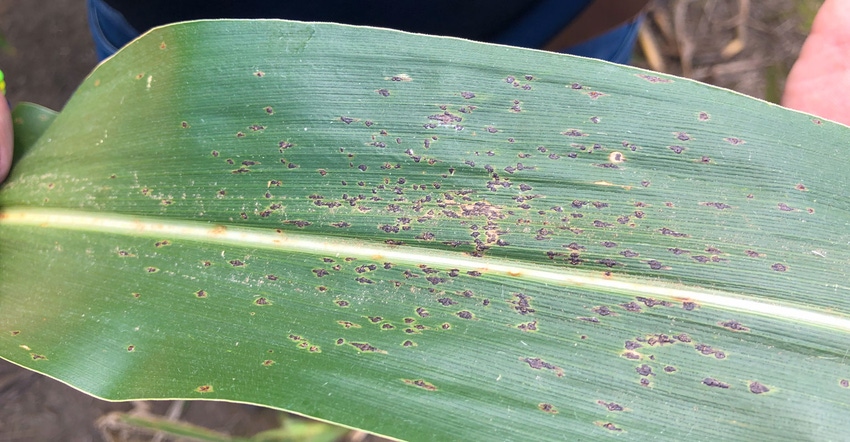
Advising. Farms then get fungicide recommendations through the Agtrinsic app. The recommendation includes which pathogens are of greatest concern (tar spot in corn, frogeye leaf spot in soybeans); a low, medium and high score is provided based on field-level risk; a flat or variable-rate fungicide application recommendation is provided based on return on investment.
In announcing the program, John Tuttle, CEO of Evergreen FS, noted: “Providing timely data that helps growers save money and improve yields is a key element of our Farmer of the Future vision. We believe this solution is a game-changer for the fungicide market.”
Stueve explains the Field Disease Risk product pulls in information about climate, disease presence or absence, canopy condition, and crop progress to help make that spraying decision.
“We’re pulling all that together, giving you an idea of whether that overall risk is high or if that overall risk is low,” he adds. “And then we go from there to rank your fields. The average grower gets a number showing risk, and they have that in the palm of their hand using near real-time growing conditions.”
Collaboration and precision
The precision Ceres Imaging adds builds on that Agtrinsic network. Stueve says the Evergreen platform can review and identify that higher risk for a more general area, and Ceres brings the more granular data that farmers need when deciding to use a fungicide.
Pricing for the service depends on the level of satellite information used. A lower-cost version with slower delivery of satellite images averages about $2 per acre, Stueve says. For more real-time information, the cost can rise to as much as $4 per acre.
Currently, this program targets central Illinois. You can learn more at agtrinsic.com and ceresimaging.net.
About the Author(s)
You May Also Like


