

Subscribe to receive top agriculture news
Be informed daily with these free e-newsletters

Colder temperatures, near-normal precipitation in Kansas expected during La Nina in Kansas
If you have the overall feeling that last winter was very warm and dry, you are right. The average temperature for December of 2015 and January and February of 2016 was 5.2 degrees above normal and precipitation for the same period was almost non-existent.
"We had a strong El Nino last winter and looking back through the records, the weather we had was pretty much on target for that," said Jack Boston, senior meteorologist and long-range forecaster with AccuWeather.

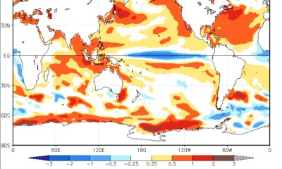
WEAK CHANGE: The change in temperatures in the equatorial Pacific is not strong enough to suggest that a La Nina will develop, and if it does, that it will be strong. Development is occurring the central Pacific, rather than the western Pacific, which will also play into the weather pattern across the U.S.
An El Nino occurs when the ocean waters of the equatorial Pacific Ocean are warmer than normal and easterly trade winds are weaker. The phenomenon causes a change in wind patterns and is especially noticeable during the winter time in the northern hemisphere.
The El Nino gave way to neutral conditions in the equatorial Pacific in June and this fall there are indications that its opposite, a La Nina, is forming, Boston said. During a La Nina, the surface waters of the equatorial Pacific are cooler than normal and easterly trade winds are stronger.
A typical La Nina winter brings slightly cooler temperatures across the central U.S. and precipitation is near normal.
Boston says the preliminary long-range forecast for the coming winter would be for Kansas to be average about half a degree to one degree below normal.
"That said, to a lot of people the coming winter is going to feel really, really cold because last winter was so mild," he said. "And where we had almost no snow last year, a normal winter would bring Wichita about 14 inches of snow. We are forecasting maybe 15 to 18 inches of snowfall for that region."
Boston said the impact for El Nino Southern Oscillation, the official name for the cyclical changes in the temperatures of the equatorial Pacific, varies depending on where the warmest or coldest water occurs.
"In some events, the greatest variation in temperature occurs in the region east of the international dateline off the coast of Hawaii and extends toward the west coast of South America. That is an eastern El Nino or La Nina. Other times, the greatest temperature variance is in the waters surrounding the dateline, which is a central El Nino or La Nina," Boston explained.
For the coming winter, the La Nina is starting to set up like a central Pacific event, he said.
"That makes a slight difference, looking back through the records, and that is what we are basing our winter forecast on at this point," he said.
ENSO effects are typically felt during the winter months in the Northern Hemisphere, Boston said, simply because the jet stream is stronger in the winter and it is the jet stream that controls the path of storm systems moving across the country.
Another major oceanic event that had an impact on the effect of last winter's strong El Nino was the Pacific Decadal Oscillation, an event that occurs in roughly 10-year cycles.
During the El Nino last winter, that event in the central Pacific was positive with cooler waters in the central Pacific and warmer waters along the west coast of California.
That is important because it tends to shift the jet stream to the north.
"That's the reason southern and central California did not get the rains that we saw with the 1997-1998 El Nino which occurred when the PDO was negative," Boston said.
Central and southern California is the only big region of the U.S. still experiencing extreme to exceptional drought, according to the U.S. Drought Monitor.
The PDO has shifted to negative, but that may be temporary, Boston said. And even if it lasts, it won't help California in this winter's La Nina, Boston said.
You May Also Like
Enter a zip code to see the weather conditions for a different location.


