Subscribe to receive top agriculture news
Be informed daily with these free e-newsletters

• Farmers throughout the world could benefit from this new (UAV) technology by becoming better managers of their crop and livestock production.
September 25, 2013
Interest is growing rapidly in the use of unmanned aerial vehicles (UAVs) for precision agricultural and environmental uses.
Media reports show agriculture could potentially be the largest user of this developing technology.
Most of the practical applications of UAVs so far have occurred in Europe and in countries like Canada, Australia and Japan where there are fewer airspace regulations compared to United States.
Use of UAVs for commercial purposes is prohibited in the United States; only hobbyists are allowed to fly small, radio-controlled airplanes for recreational purposes.
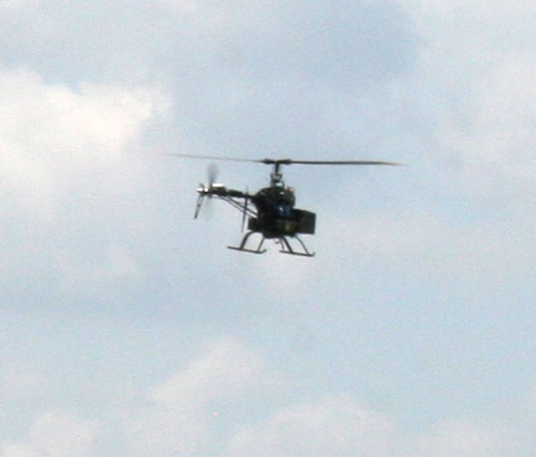
Currently, there are two broad platforms for UAVs, namely the ‘Fixed Wing’ and ‘Rotary Wing’ (copter) types.
Fixed wing UAVs have the advantage of being able to fly at high speeds for long durations with simpler aerodynamic features. Some of them do not even require a runway or launcher for takeoff and landing.
The rotary wing UAVs have the advantage of being able to take off and land vertically and hover over a target. However, because of mechanical complexity and shortened battery power, they have a short flight range.
These UAVs fly up to an altitude of 400 feet and are able to follow the same path or GPS-guided routes daily, weekly or as desired.
Cameras gather images with normal light, infrared or thermal, still photos or video formats. These images are digitized, geo-referenced and mapped.
Crop consultants and farmers can use this information to scout crops, detect nutrient deficiencies, assess flood or drought damage, forecast weather patterns, monitor wildlife and even locate cattle in distant pastures.
Research also reveals that UAVs can be used for detecting atmospheric microbes and air pollution.
Spot-spraying chemicals and micronutrients is another use.
Some major non-agricultural uses of UAVs include news reporting, photography, surveillance, traffic control, real estate and search and rescue missions.
Satellite images are currently used for remote sensing, but they are costly and do not have the desired resolution. Satellite images are also affected by cloud cover.
Because of the growing interest and potential demand for this technology, the U.S. Congress has directed the Federal Aviation Agency (FAA) to write regulations on how the UAV technology can be used for commercial purposes and specify restrictions for their use.
The progress has been slow, however, because of public safety and privacy concerns, and objections from consumer rights groups. The FAA currently allows special certifications for non-profit organizations such as universities and the military to test whether these devices can safely be integrated into the national air space. The expectation is that the FAA will formulate these regulations sometime next year.
Delays in drafting guidelines and the legislative debate process can stifle research and development of this technology by local designers and entrepreneurs. Dozens of U.S. companies have already invested and are competing in the global UAV market. The UAV industry has the potential to provide thousands of high-tech jobs in this country.
Click the following to watch short YouTube videos on UAVs.
• senseFly’s eBee drone maps Swiss alpine valley
• Remote-controlled helicopter tested for use in vineyard applications
You May Also Like
Enter a zip code to see the weather conditions for a different location.


