Subscribe to receive top agriculture news
Be informed daily with these free e-newsletters

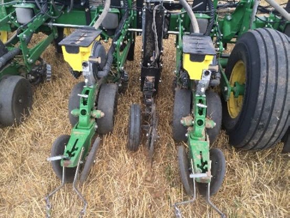
Media release: The I Series (implement-mounted) sensors were developed to help growers and consultants precisely map and manage soil variability .
March 10, 2017
Editor’s Note: This company media release is unedited, for your information.
Veris Technologies has unveiled a new line of on-the-go soil sensors that easily mount to planters and tillage tools. The I Series (implement-mounted) sensors were developed to help growers and consultants precisely map and manage soil variability while performing other field operations. The iScan, the first in the new series, features soil sensor modules that map soil organic matter below the soil surface and soil texture variability to a depth of two feet. This new platform deploys proven Veris optical and electrical sensing components in a flexible format that allows for immediate visualization and decision making.
“As growers look to the soil to guide their precision ag efforts, the demand for Veris maps created a need to more rapidly collect accurate and high resolution soil data,” said Eric Lund, president of Veris Technologies. “We¹re excited to introduce a powerful and scalable soil mapping solution so farmers and advisors can use this foundational information on every acre.”
The I Series, along with the recently introduced U Series (utility vehicle mounted sensors), utilizes a sensor module which houses the Infrared and Red light sensors. This dual-wavelength optical sensor measures the color of the soil below the surface to determine organic matter levels. Veris soil texture readings are gathered by measuring the electrical conductivity (EC) of the soil. Because the electrical current travels two feet into the rooting zone, these readings provide soil depth and water-holding capacity information that has significant implications on management decisions.
“Whether creating variable rate seeding prescriptions, guiding fertility sampling or improving nitrogen management, Veris EC and OM maps will allow growers to manage each soil accurately and avoid costly mistakes caused by coarse maps and misleading images,” Lund said.
You May Also Like
Enter a zip code to see the weather conditions for a different location.


