

Subscribe to receive top agriculture news
Be informed daily with these free e-newsletters

Powerful, proposed cellular network could compromise GPS signals.Agriculture in battle to pull the plug or at least modify threat to important technology.GPS technology is extremely important to California and American agriculture now and in the future.“GPS is a very valuable tool that we use on a daily basis on our farm," says sixth-generation Los Banos, Calif., farmer Cannon Michael. "Any degradation or disruption of this service would be devastating for the farmers in California and the nation."
April 11, 2011
Agriculture is in the thick of a fierce battle being waged before the Federal Communication Commission (FCC) to pull the plug or at least modify a company’s effort to bolster its cellular network at the expense of the integrity of Global Positioning System (GPS) signals.
A company named LightSquared owns a satellite communications network but wants to get into the more popular and profitable land-based cellular business.
It has asked the FCC for a conditional waiver, so it could broadcast much more powerful land-based signals than it's been doing for the past 15 years.
The problem, according to a coalition of GPS users called SaveOurGPS, is that the land-based communications towers could interfere with GPS. The signal that emanates from LightSquared towers, tests have shown, will degrade GPS signals to the point where a GPS user could not get a fix, according to Garmin spokesman Ted Gartner.
LightSquared plans to transmit ground-based radio signals that would be 1 billion or more times more powerful than GPS's low-powered satellite-based signals, potentially causing severe interference impacting millions of GPS receivers - including those used by the federal agencies, state and local governments, first responders, airlines, mariners, civil engineers, construction and surveying companies, agriculture workers and everyday consumers in their cars and on handheld devices.
Garmin is one of more than 40 member associations or companies in the SaveOurGPS coalition. This includes all the major farm equipment manufacturers like Caterpillar, John Deere, and Case New Holland. The others in the coalition range from car rental agencies to UPS to several aviation associations.
The coalition says that the FCC issued its conditional waiver allowing LightSquared to build its network of towers without appropriate testing. LightSquared, for its part, says it certainly does not wish to interfere with GPS signals.
"We not only have to have a robust wireless broadband network, we have to have a robust GPS network. They both have to work," said LightSquared Executive Vice President Jeff Carlisle.
This is not a chicken fight. It is a brawl. If agriculture and the coalition do not stop this effort it could set back a technology that a California farmer says is by comparison as significant as the development of the steam engine in the industrial revolution.
“The bottom line is that GPS technology is extremely important to California and American agriculture now and in the future,” says Cannon Michael, vice president of the 10,500-acre Bowles Farming Company in Los Banos, Calif., who is also the chairman of California Cotton Growers Association.
“GPS is a very valuable tool that we use on a daily basis on our farm. The use of GPS and variable rate technology tells such a good story for agriculture and shows that we are using technology to apply less pesticide in a more accurate way. Any degradation or disruption of this service would be devastating for the farmers in California and the nation,” said the sixth-generation farmer.
Bowles Farming is typical of many California and Arizona producers in using GPS on the farm in a variety of cost-saving operations.
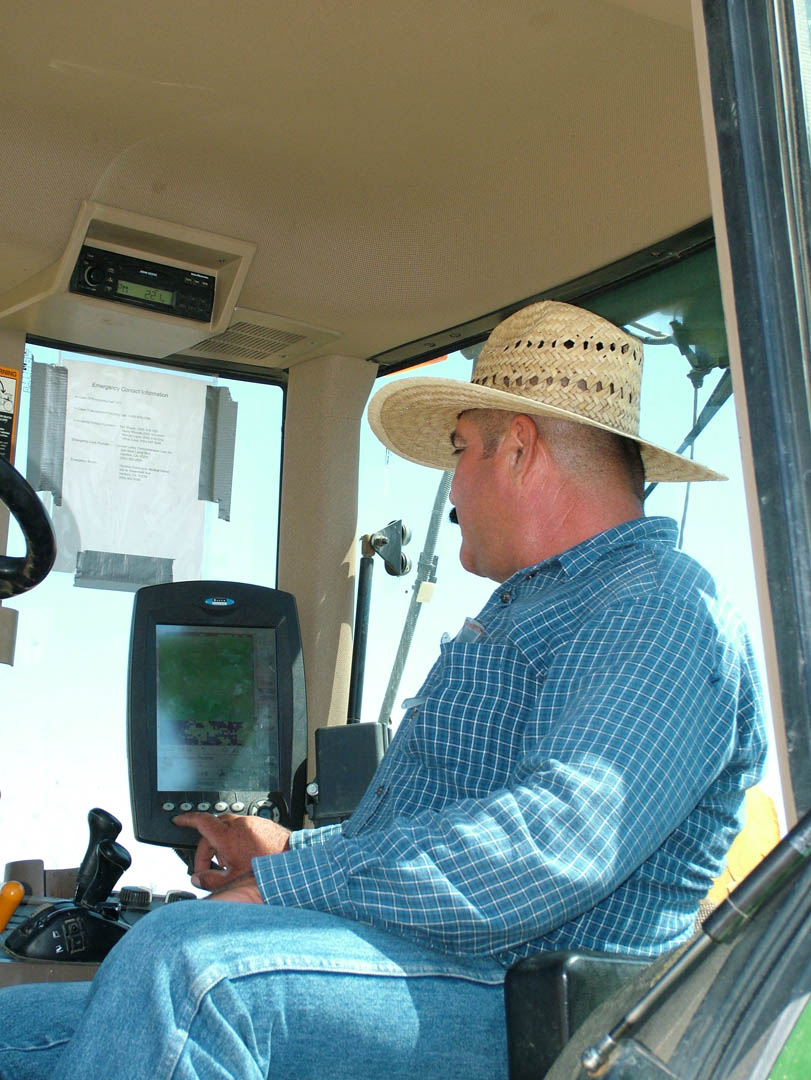
�“GPS tractor guidance is one of the most important uses and the benefits are easily understood and quantified,” said Michael. “I am sure this is the most widely adopted form of GPS use in agriculture. Being able to pull wide implements without any overlap is a huge savings in time and diesel.” Michael also pointed out that there is less dust and emissions because of this greater efficiency. There is also less fatigue for the tractor driver “since concentrating on driving straight is very taxing.”
Bowles has been using GPS yield monitoring technology in cotton for many years. “It helps us find locations in fields that are under performing. We can then go to these areas using GPS and determine what the problem is.”
Using GPS, GIS, imagery and yield monitoring, Michael can also identify areas of variability within fields. “GPS allows me to sample soil and tissue in areas of interest in my fields and come up with prescriptions on what each area needs.”
Variable rate technology (VRT) was quickly coupled with GPS mapping when it was introduced a decade ago for more precision in applying chemicals and fertilizers.
At Bowles Farming in Merced County, an application file can be emailed to an aerial applicator that he can then insert in the rate controller of his plane. ”He sees the field I want applied on his controller and flies to it using GPS,” explained Michael.
The file also contains data that tells the controller where Michael wants to spray and how much volume to be applied at those locations.
“The pilot just flies the plane over the field and the controller opens valves at the locations I want sprayed. This would not be possible without GPS,” he said.
Bowles gets back a file showing the aerial applicator’s flight pattern showing where he sprayed and how much he put out at each location.
“This record is valuable and could be used to solve disputes or for claims if there was a report of damage from one of our applications. This technique puts the material exactly where it should go and results in less chemicals being used. We use variable rate by air for many PIX applications in cotton every year,” Michael explained.
Bowles uses GPS with ground applications in much the same way. “We can generate files that tell the sprayer when to turn on and off in the field. We also apply a lot of soil amendments (sulfur, potash, zinc, gypsum) by ground with large spreader trucks equipped with rate controllers and GPS. The gate on the back of the truck opens and closes at locations determined by the file I give him and the location to put the right amount of material at the locations I specify. This saves considerable material and also targets the areas of the fields to meet specific needs. No more ‘broad brush’ spreading of the entire field,” Michael said.
Bowles also relies on GPS for land reclamation.
“Using GIS and imagery, I have identified over 300 acres of under-producing spots. With GPS, I can go and analyze each of these spots and come up with a plan to target and improve them.”
Most of the spots are salty and low in organic matter. “We have been using variable rate technology (made possible with GPS) to spread compost on these spots to add organic matter. Compost is expensive, but we can apply it to only the areas that we are working on. Land in our area costs more than $6,000 per acre. I can afford to spend money on these spots to bring them back into production. I wouldn't be able to purchase land for the cost of reclaiming these spots.”
Michael expects to expand the uses of GPS technology for equipment tracking and recovery, as well as in meeting California’s growing regulatory requirements placed on farming.
“Regulators are looking at limiting nitrogen, and, at some point, we may only be able to apply it using variable rate,” he noted. This also goes for pesticides and herbicides applied near water.
“Using variable rate, you have a record of where you sprayed and you can put in a buffer where the controller will automatically shut off the spray when it gets within a certain distance of a water body.”
None of this would be possible without a reliable, accurate GPS satellite signal. The SaveOurGPS has told the FCC that the conditional waiver issued to LightSquared would jeopardize that.
LightSquared says it does not wish to interfere with GPS signals.
To safeguard GPS, the Coalition seeks a number of remedies from the FCC, including:
1. The FCC must make it clear that LightSquared�’s license modification is contingent on the outcome of a mandated study. That study must be overseen by a strong neutral observer, not by an interested party.
2. The FCC should make clear that LightSquared and their investors should not proceed to make any investment in operating facilities prior to a final FCC decision.
3. Further, the FCC’s finding that “harmful interference concerns have been resolved” must mean “resolved to the satisfaction of pre-existing GPS providers and users.”
4. Resolution of interference has to be the obligation of LightSquared, not the extensive GPS user community of millions of citizens. LightSquared must bear the costs of preventing interference emanating from their devices. GPS users or providers should not have to bear any of the consequences of LightSquared’s actions.
5. This is a matter of critical national interest. There must be a reasonable opportunity for public comment of at least 45 days on the report produced by the working group and further FCC actions on the LightSquared modification order should take place with the approval of a majority of the commissioners, not at the bureau level.
Global Positioning System (GPS) technology has become a worldwide utility affecting nearly every facet of modern day life. The free, open and dependable nature of GPS enables users such as farmers, pilots, boaters, surveyors, construction workers, hikers, delivery drivers, dispatchers, lumberjacks, police officers, firefighters, and people from many other walks of life to do their jobs. GPS has already become a critical part of our national infrastructure and practically every day there are new uses for GPS being developed.
You May Also Like
Enter a zip code to see the weather conditions for a different location.


