


Subscribe to receive top agriculture news
Be informed daily with these free e-newsletters
February 1, 2013
Over the past year, the market for ag-specific smartphone and tablet computer applications has gone mainstream. Now many of the big names in agriculture are offering apps to improve crop and machinery management.
Here’s a look at some of the new offerings for Android and iOS (Apple) smartphones and tablet computers.
AGCOMMAND, AGCO’s telemetry service for remote machinery monitoring of Challenger, Massey Ferguson and Valtra tractors, harvesting and application equipment, and fleet vehicles now has a mobile application for iPhone and iPad mobile devices. Available as a free download at the Apple App Store, it provides integrated weather radar at machine locations, turn-by-turn directions to machines, machine data history and more.
John Deere Mobile Farm Manager, a free iPad/iPhone application, offers anywhere access to important farm and field information stored on customers’ Apex farm management software. The app allows the user to view field maps, historical reports, GPS tracking, field navigation, soil sampling grids and more. It also streamlines sharing of agronomic information with ag service providers, farm managers and other advisors.
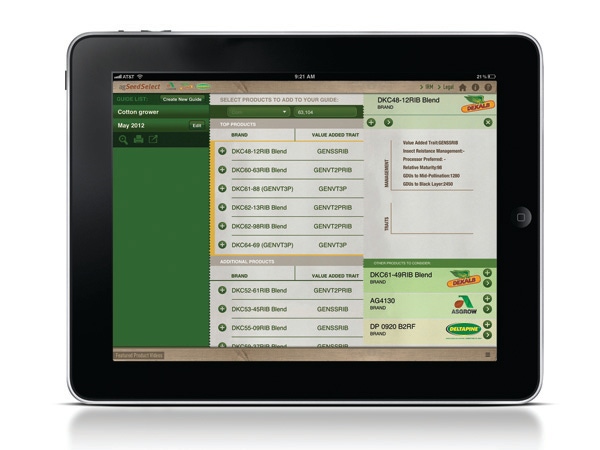
Monsanto’s Asgrow, Dekalb and Deltapine brands now offer agTools, a suite of mobile applications that delivers weather radar maps, commodities and exclusive agronomic information, industry news, grain elevator pricing and more to Android and iOS tablets and smartphones. Special functions include agSeedSelect, which lets farmers create, store, email and print a seed guide tailored to their specific geography and crops, and Weed Manager Plus, for region-specific weed management recommendations, a tank-mixing tool, videos outlining best management practices and a measurement conversion calculator. The application is available free from the Apple App and Google Play stores.
Trimble’s Connected Farm app uses the built-in GPS of smartphones for collecting in-field information, including mapping field boundaries, marking flags, taking geo-referenced photos and entering scouting information for pests using an extensive built-in list of weeds, insects and diseases. Information can be viewed, sorted, printed and analyzed by sending it to Trimble’s Connected Farm Web solution for free online access, or by transferring the data to Farm Works Office software. The application is available free from the Apple App and Google Play stores.
AgStudio MAP from MapShots is designed to map field boundaries and record precision ag soil sampling data for integration with MapShots AgStudio precision agronomy software. Co-developed with Cogent3D, the iOS application is available for free download at the Apple App Store.
AgJunction Mobile is an iOS-based in-field data-collection system featuring GPS-enabled boundary mapping and soil sampling for synchronizing direction with AgJunction precision software. Also developed in conjunction with Cogent3D, AgJunction can be downloaded from the Apple App Store and unlocked by entering the AgJunction license key, user name and password.
ZedX recently launched a free mobile device application to complement its Web-based AgFleet service. Features include boundary mapping, soil sampling, field directions and in-field navigation to sample points. The application is available on the Apple
App and Google Play stores.
You May Also Like
Enter a zip code to see the weather conditions for a different location.


