Subscribe to receive top agriculture news
Be informed daily with these free e-newsletters

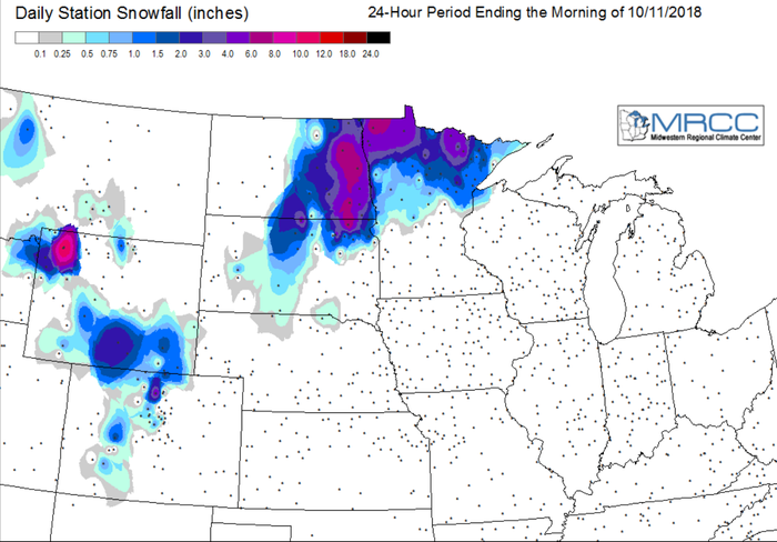
Check out this gallery of weather maps to see exactly what was recorded at various weather stations.
It's no secret, that #harvest18 has been slow moving thanks to significant precipitation falling across the Midwest.
A major storm dumped heavy precipitation (2 to 6 inches) across large sections of the Plains and upper Midwest, leading to fieldwork stoppages and lowland flooding. The combination of heavy rain followed by cold weather led to crop quality concerns, especially with regard to soybeans in the western Corn Belt.
As the storm pulled eastward, the season’s first significant snowfall blanketed parts of the Rockies, northern Plains, and far upper Midwest. Weekly temperatures averaged at least 5 to 15°F below normal across much of the Plains and upper Midwest, with freezes occurring throughout the northern half of the Plains and the upper Great Lakes region.
Now that combines are back rolling, let's hope the ground gets dried out and #harvest18 ends on a good note.
Check out this gallery of weather maps to see exactly what was recorded at various weather stations.
You May Also Like
Enter a zip code to see the weather conditions for a different location.


