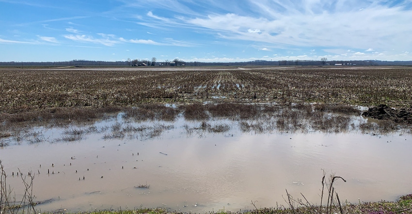
Rain continues to track across much of Missouri this spring, causing problems for fieldwork and planting.
In places such as Jackson, Mo., in the bootheel region, farmers are dealing with almost 21 inches of precipitation during the first three months of the year. That is 8 inches above average for the almost 30 years of weather data dating back to 1981.
Areas in the central part of Missouri around Columbia and Jefferson City have seen close to 15 inches of precipitation since Jan. 1.
Missouri is coming off its third consecutive wet winter, says Pat Guinan, University of Missouri Extension climatologist. He says it is the 19th-wettest winter in the 125 years of National Weather Service records.
Wet conditions remain
Compared to the 1981-2010 norm from Jan. 1 to April 1, weather stations experienced an average 56% increase in rainfall. Many of the wettest conditions were reported in the southern portion of the state.
Check the map below for accumulative rainfall for the first three months of this year:
Saturated soils
The state’s farmers and ranchers are coming off an unprecedented 2019.
“Unusually wet conditions have prevailed since the beginning of 2019, with 10 of 14 months recording above-average precipitation,” Guinan said in a MU press release. He found that the preliminary annual statewide precipitation average last year was 53.81 inches, making it the seventh-wettest year on record.
Weather gauges from Missouri Mesonet, the National Weather Service and the Community Collaborative Rain, Hail and Snow Volunteer Network recorded more than 80 inches of rainfall in 2019 in parts of McDonald and Newton counties, and more than 70 inches in several other southwestern Missouri counties and the bootheel.
Wet conditions continued into the new year, delaying timely nitrogen applications to wheat in some areas.
According to the National Weather Service Climate Prediction Center, much of Missouri is expected to have more than 30% above-normal precipitation during April. That percentage shifts closer to 40% in the southern and southeastern regions of the state.
The state needs some high temperatures to dry out. However, NWS is not predicting higher-than-normal temperatures for April.
University of Missouri Extension contributed to this article.
About the Author(s)
You May Also Like


