Subscribe to receive top agriculture news
Be informed daily with these free e-newsletters

The goal is to increase the effectiveness of the Kansas Flint Hills Smoke Management Plan.
September 25, 2018
Kansas State University researchers are part of a large collaborative project that is using unmanned aircraft to improve the Kansas Flint Hills Smoke Management Plan.
The three-year project is funded by the Kansas Department of Health and Environment, or KDHE, and involves university scientists; NASA scientists; unmanned aircraft systems pilots from the Kansas State University Polytechnic Campus; meteorologists; ranchers; and environmentalists. The research team members have varied backgrounds, but they all share a common goal: improve the environment and human health while balancing the livelihood of ranchers and farmers.
"We want to have our data be useful for keeping fire as a practice that is both ecologically acceptable and socially acceptable in the Great Plains," says Carol Baldwin, project leader and a K-State Research and Extension associate in the College of Agriculture.
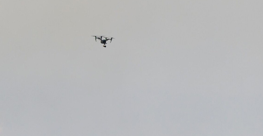
The team is collaborating with a Flint Hills rancher to gather data during typical tallgrass prescribed burns. The researchers have attached sensors to unmanned aircraft to gather air quality information during a burn.
The information they gather is helping NASA verify satellite data products. It is also facilitating collaboration between KDHE and the Environmental Protection Agency to improve the Kansas Flint Hills Smoke Management Plan. The plan was implemented in 2011, and helps ranchers make decisions about the best days to burn without negatively affecting human health, particularly in metropolitan areas.
In the past, when the weather conditions were right, Flint Hills spring burning affected air quality in Wichita, Topeka, Kansas City and metropolitan areas in Nebraska and Oklahoma. The poor air quality is bad for people with asthma and other health problems. The challenge is that fire is needed to maintain the integrity of the tallgrass prairie landscape, Baldwin says.

"We need fire," says Baldwin, who is an expert in grassland range management. "If we take fire and grazing out of the ecosystem, we will not have prairies as we know them. We will end up with a scrubby woodland."
Current smoke management models, such as the Flint Hills plan, use data from fires in other parts of the U.S., not in the Great Plains, Baldwin says, and that's a problem. The university-led project wants to get more accurate fire data from the Great Plains region by working with real ranchers during a typical burn.
"It is our hope that ranchers in the Flint Hills will use these tools to plan their burns, so they do not impact air quality downwind from the fire," says Doug Watson, air monitoring and planning chief with the Kansas Department of Health and Environment. "At the same time, we want to educate the metropolitan areas about the importance of the Flint Hills ecosystem and the reasons why the ranchers burn to maintain that ecosystem."
Using unmanned aircraft
To test a prescribed burn, the researchers are working with Jane Koger, a Matfield Green rancher. Koger has allowed the researchers to collect data before, during and after the annual burns on her ranchland.
UAS pilots gather smoke emissions from a controlled burn by flying three unmanned aircraft into the smoke above the fires. The unmanned aircraft use continuous sensors and sample sensors to measure particles and ozone-causing chemicals, and they use thermal imaging to measure fire temperature. The continuous sensors use lasers to take measurements and send data, including particle concentration, ozone levels, temperature and humidity. The sample sensors have a small bag to gather and bring back air particulate samples that are analyzed for particulate matter, or PM, as well as nitrogen dioxide and volatile organic carbon, or VOC, levels.
Travis Balthazor, UAS flight operations manager, is leading the team of 12 trained UAS pilots, which includes researchers and students with the Kansas State University Polytechnic Campus. The students are getting real-world experience through the project, Balthazor says.

"This is outside the realm of our normal box, so this is an effort that benefits us in the long run," Balthazor says. "As far as operating aircraft and looking to the future of unmanned aircraft, everybody wants to fly beyond line of sight and they want to fly higher. We are getting a taste of that with this project."
After the burn
After each burn, the researchers have a record of grass biomass that was burned, the fire's heat levels and the emission levels from the fire.
This data is helping NASA verify satellite imagery and remotely driven emissions estimates. NASA uses imaging from satellite data to determine a fire's intensity and smoke emission rates. To complete validation, researchers combine direct measurements of black carbon production with data from a thermal camera that measures the full range of a fire's internal temperatures. The research also helps NASA improve satellite data models.
Other project collaborators — such as Deon Van Der Merwe, adjunct faculty member in diagnostic medicine and pathobiology in the university's College of Veterinary Medicine — are using the unmanned aircraft to estimate fire size by flying aircraft above grassland before a prescribed burn to determine how much grass, trees or shrubs are in the area.
For Koger, the research project can help ranchers like her learn how to maintain the tallgrass prairie without damaging their livelihoods.
"I think it's important to get a better understanding of what we are doing and what we are putting into the air," Koger says. "We have kids and grandkids, and some of them have asthma. It does affect all of us. When we have concrete science — and when K-State shares that — ranchers listen. Getting some numbers and knowing what we are really doing and getting that back out to the public will speak to people."

Large group of collaborators working on smoke data project
Here is the full list of Kansas State University collaborators:
Carol Baldwin, K-State Research and Extension range management associate in the College of Agriculture; Travis Balthazor, UAS flight operations manager, David Burchfield, teaching assistant professor of unmanned aircraft systems, and Kurt Carraway, UAS research executive director, all with Kansas State University Polytechnic Campus; Zifei Liu, assistant professor of biological and agricultural engineering in the College of Engineering; Randall Mai, research technologist in agronomy and weather station technician with Kansas Mesonet; Christopher Redmond, assistant scientist in agronomy and network manager with Kansas Mesonet; and Deon Van Der Merwe, adjunct faculty member in diagnostic medicine and pathobiology in the College of Veterinary Medicine and Utrecht University faculty member.
Here is the full list of other people collaborating on the project:
Jane Koger, a commercial rancher from Matfield Green; Jayson Prentice, technical resources and projects unit supervisor, Kathleen Waters, environmental program administrative supervisor, and Doug Watson, air monitoring and planning chief, all with the Kansas Department of Health and Environment; Charles Ichoku, research physical scientist with the Climate and Radiation Laboratory at NASA Goddard Space Flight Center; Luke Ellison, scientist with Science Systems and Applications Inc. at NASA Goddard Space Flight Center; and David Bush, senior scientist with Technical and Business Systems Inc., a California-based company that developed the unmanned aircraft sensors.
Source: Kansas State University News Service
You May Also Like
Enter a zip code to see the weather conditions for a different location.


