July 16, 2019

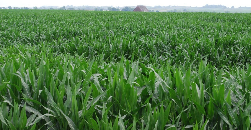
For the week ending July 14, USDA’s statewide survey shows 62% of Iowa’s 2019 corn crop is in good-to-excellent condition. The state’s soybean crop is 63% good-to-excellent. The survey shows 8% of Iowa’s corn has begun to silk, 13 days behind last year and 10 days behind the five-year average. And 26% of the state’s soybean crop has started to bloom, 12 days behind last year and 9 days behind average.
In comparison, the nation’s corn crop is rated 58% good-to-excellent. The U.S. soybean crop is 54% good-to-excellent. USDA says 17% of the nation’s corn crop is in silk stage, compare to 42% for the five-year average. And 22% of the U.S. soybean crop is blooming, well below the five-year average of 49% for this date.
"It was a hot, dry weekend across the state, and climatologists expect that trend to continue throughout this week," notes Iowa Agriculture Secretary Mike Naig. "As I'm traveling the state, I've noticed the earliest-planted corn is starting to tassel."
The weather forecast for this next week is calling for daytime high temperatures in the 90s and possibly even in the 100s across the state, and low nighttime temperatures in the 70s to 80s with little chance of rainfall. The hot, dry weather forecast is raising concerns on what impact this can have on the corn crop, especially with the earlier planted corn starting to tassel and pollinate.
The complete weekly Iowa Crop Progress and Condition Report is available on USDA’s site at nass.usda.gov/ia.
Crop report
It was a dry week in Iowa allowing farmers six days for fieldwork during the week ending July 14, according to USDA’s National Ag Statistics Service. This was the most days suitable for fieldwork this season. The recent dry weather helped farmers catch up on fieldwork; however, some areas in Iowa now need rain to help crops continue to move along.
Topsoil moisture is rated 1% very short, 14% short, 78% adequate and 7% surplus. Districts in the southern third of Iowa report topsoil moisture conditions with over 25% short to very short. This is the first time this season any district in Iowa reported topsoil moisture condition at 25% or higher as short to very short.
Subsoil moisture is rated 0% very short, 9% short, 80% adequate and 11% surplus. As of July 14, the survey shows 8% of Iowa’s corn crop has begun to silk, 13 days behind last year and 10 days behind the five-year average.
Corn condition is rated 62% good-to-excellent. Nearly all of Iowa’s 2019 soybean crop has emerged, at 98% statewide. And 26% of the bean crop has started to bloom, 12 days behind last year and nine days behind average.
Soybean condition is rated 63% good-to-excellent. Iowa’s oat crop is 96% headed, a week behind average. And, 55% of the crop has started coloring, five days behind both last year and average. Oat condition improved from previous week to 65% good-to-excellent.
Nearly all of Iowa’s first cutting of alfalfa hay has been cut, now at 98% complete. Second cutting of alfalfa hay has reached 33%, 11 days behind last year and nine days behind average. Hay condition is 61% good-to-excellent. Pasture condition declined to 65% good-to-excellent. Livestock are experiencing some stress due to heat.
Weekly weather summary
Most of Iowa had unseasonably dry conditions during the week ending July 14, says Justin Glisan, state climatologist at the Iowa Department of Agriculture. Driest conditions were across the state’s southern half; rainfall departures were between 1 to 1.25 inches below normal.
Temperatures were near normal across much of Iowa, with some sections reporting slightly warmer than average conditions. Statewide average temperature was 75.3 degrees, 0.6 degree above normal for the week.
Partly to mostly sunny conditions were seen statewide Sunday (July 7) afternoon with light variable winds. High temperatures were in the low to mid-80s, near to slightly below average by one or two degrees. Overnight lows into Monday were in mid-to-upper 60s. Pleasant conditions continued through the day. A southerly wind pushed highs into the mid-80s under mostly clear skies.
A line of showers in advance of an approaching low-pressure system brought light rain to a few counties in southwest Iowa; totals ranged from 0.03 inch in Holly Springs (Woodbury County) to 0.16 inch in Council Bluffs (Pottawattamie County).
Thunderstorms refired Tuesday ahead of a warm front in late morning and continued into eastern Iowa during late evening. There were two reports of an isolated, weak tornado in Scott County.
Rainfall totals at 7 a.m. Wednesday were highest across northern and eastern Iowa with Rock Valley (Sioux County) reporting 1.35 inches. Three stations in Clinton County had totals from 0.85 to 0.87 inch. A cold front moved through Iowa on Wednesday, bringing light showers to southwest Iowa. Spotty showers popped up in eastern Iowa later in the evening. Rain totals for the day were generally under 0.10 inch. Northwest flow kept highs in the upper 70s and low 80s.
Hail hit areas in northwest Iowa
Dry conditions returned on Thursday, with seasonable temperatures under sunny skies. Average statewide high was 85 degrees. Storms returned to Iowa Friday, some of which were severe. There were two reports of 1-inch hail at Hawarden and Maurice in Sioux County. The storms stayed in western Iowa and dissipated after sunset.
Thunderstorms moved into Iowa in early morning hours on Saturday (July 13) bringing another round of locally heavy rain. Higher totals were reported from stronger storms with Mapleton (Monona County) receiving 1.05 inches. Conditions were nice for the rest of the day with partly to mostly sunny skies. High temperatures remained seasonal, in the low to mid-80s; 90s were reported across southern Iowa. Overnight temperatures into Sunday were in low to mid-70s, averaging 6 degrees warmer the normal statewide.
Weekly rainfall totals ranged from no accumulation at multiple south-central and southeast stations to 1.75 inches in Cherokee (Cherokee County). Statewide weekly average precipitation was 0.30 inch, less than one-third of the normal 1.05 inches. The week’s high temperature of 93 degrees was reported July 13 in Donnellson (Lee County), Lowden (Cedar County), Muscatine (Muscatine County) and Osceola (Clarke County). These readings are on average 7 degrees above normal. Elkader (Clayton County) and Stanley (Buchanan County) reported the week’s low temperature of 54 degrees on the July 13, 7 degrees below average.
About the Author(s)
You May Also Like


