June 11, 2019
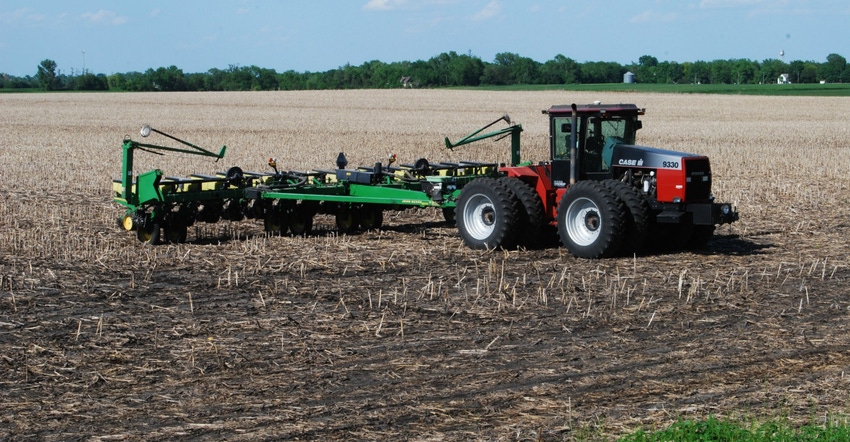
As of June 9, Iowa farmers had 93% of the state’s 2019 corn crop in the ground. Corn planting is usually 100% complete by this date. Iowa now has 70% of its expected soybean crop planted, and the five-year average is 95%.
“This latest USDA weekly Crop Progress report shows that with crop insurance coverage in mind, farmers are hustling to finish planting,” says Eric Larson, farming in Cedar County in eastern Iowa. Each day after May 31 is a 1% reduction in crop insurance protection for the corn crop in Iowa. The crop insurance deadline planting date for soybeans in Iowa is June 15.
�“It’s been a planning and planting dilemma this spring,” Larson says. “For many farmers, the first choice is to plant corn. Likely second choice is to take the prevented planting option crop insurance offers. Third choice is to switch fields from corn to beans.”
“Last week farmers finally got a much-needed break from the rain and were able to make significant progress on fieldwork,” notes Iowa Ag Secretary Mike Naig. “Many breathed a sigh of relief as they finished planting over the weekend. If the favorable weather continues, most of the state should be done planting by the end of this week.”
While this is one of the latest planting seasons on record for Iowa, the eastern Corn Belt is running even further behind. Illinois farmers had 73% of their corn planted as of June 9, while their five-year average is 100%. Indiana had 67% planted versus a five-year average of 98%.
USDA says the nation’s corn planting is now 83% complete compared to a five-year average of 99%. This indicates nearly 16 million U.S. corn acres remain unplanted. The U.S. soybean crop is 60% planted versus an 88% five-year average.
The complete weekly Iowa Crop Progress & Condition Report is on USDA’s site at nass.usda.gov/ia.
Crop report
Iowa farmers finally got the drier weather they were looking for with 5.2 days suitable for fieldwork statewide during the week ending June 9, according to USDA’s National Ag Statistics Service. This is the first time this season farmers had more than five days suitable for fieldwork. It allowed Iowa farmers to plant corn and soybeans, cut hay, spray fields, and apply nitrogen.
Topsoil moisture is rated 0% very short, 1% short, 73% adequate and 26% surplus. Subsoil moisture is 0% very short, 0% short, 67% adequate and 33% surplus.
As of June 9, the survey shows 93% of the expected 2019 Iowa corn crop has now been planted, over two weeks behind last year and almost three weeks behind the five-year average. The state’s corn crop is 73% emerged, over two weeks behind last year and two weeks behind average. Corn condition is rated 58% good-to-excellent.
Nearly one-third of Iowa’s expected 2019 soybean crop was planted last week. Iowa soybean growers now have 70% of the expected crop planted, 17 days behind last year and 17 days behind average. Iowa’s soybean crop is 35% emerged, over two weeks behind last year and two weeks behind average.
Nearly all the oats crop has emerged with 18% of the crop headed, a week behind last year and eight days behind average. Oat condition is rated 63% good-to-excellent.
Nearly one-third of Iowa’s first cutting of alfalfa hay was cut this past week. However, at 35% complete statewide, the first cutting is behind last year by 10 days and eight days behind average. Hay condition improved to 63% good-to-excellent. Pasture condition rated 66% good-to-excellent, also an improvement. There was little stress on livestock this past week, but feedlots remain muddy.
Weather summary
A large-scale circulation shift brought a much less active pattern across the region, says Justin Glisan, state climatologist at the Iowa Department of Agriculture and Land Stewardship.
Given the long stretch of wetness during spring, the current dry period is a welcome break. Temperatures last week were unseasonably warm, generally 3 to 6 degrees F above average. Most of Iowa experienced rainfall departures between 0.5 to 1 inch below average.
The week began with Sunday (June 2) afternoon and evening mostly sunny and slightly cooler than average with highs in low to mid-70s. A fast-moving wave of showers and thunderstorms entered western Iowa in the early morning Monday (June 3). The system moved through southern Iowa most of the day and dissipated Monday evening.
Rain totals were highest in southwest and eastern Iowa. Randolph (Fremont County) had 1.55 inches, while across the state in Dubuque (Dubuque County) 1.67 inches was reported, 1.36 inches above average. The swath of Iowa between these two locations generally saw totals from 0.10 to 0.50 inch.
Tuesday was active across northeast Iowa as showers and moved through from late evening through early Wednesday (June 5) morning. Highs were in the low to mid 80s, on average 4 to 6 degrees above normal, helping fuel the storms. Rain totals were highest in northeast Iowa with four stations reporting above an inch; Cascade (Dubuque County) had 1.77 inches. Remaining totals across this region ranged from 0.25 to 0.75 inch, with the average total around 0.44 inch.
A line of storms re-fired in east-central Iowa on Wednesday afternoon. Rain totals varied from 0.20 inch in Newton (Jasper County) to 0.87 inch in Garwin (Tama County). The line dissipated as it moved through southeast Iowa, with a strong thunderstorm popping up in Van Buren County. Severe hail was reported in Keosauqua. The end of the week was less active with warmer-than-average conditions. Northwest Iowa reported highs near 90 degrees on Thursday. Statewide temperatures averaged 86 degrees, 8 degrees above average. Overnight lows were above average as well.
Friday (June 7) was sunny, unseasonably warm with low humidity. High temperatures reached the mid to upper 80s, 4 to 6 degrees above average. Overnight lows into Saturday remained warmer than average, dipping into the mid-60s. Conditions through the day on Saturday remained pleasant with continued sunny and dry in Iowa.
Temps were near to above average with high 80s in the north and low to mid 80s across southern Iowa. A weak cold front brought isolated measurable rain to extreme northwest Iowa late Saturday into Sunday morning, with accumulations ranging from 0.02 inch in Sioux City (Woodbury County) to 0.39 inch in Akron (Plymouth County).
Weekly rain totals ranged from no measurable accumulations at a handful of stations to 2.17 inches in Fulton (Jackson County). Statewide weekly average rainfall was 0.52 inch, just under half of the expected 1.18 inches. Temperatures averaged 71.8 degrees, 4.3 degrees above normal.
The week’s high temperature of 91 degrees was at Hawarden and Sioux Center (Sioux County) and Rock Rapids (Lyon County) on June 6; this was on average 13 degrees above normal. Cresco (Howard County) reported the week’s low temperature of 44 degrees June 3 — 7 degrees below average.
About the Author(s)
You May Also Like


