May 21, 2019

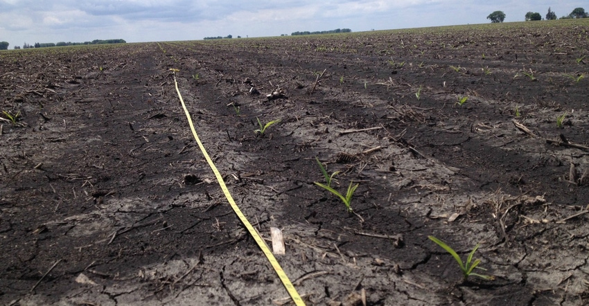
Iowa farmers made some progress in getting corn and soybean crops planted last week, despite only 2.7 days suitable for fieldwork due to continued wet conditions. Iowa’s 2019 expected corn acreage is now 70% planted, according to the weekly survey released May 20 by USDA’s National Ag Statistics Service. Iowa has 27% of its soybean crop in the ground.
Survey results for the seven days ending May 19 show Iowa is still running behind normal. The five-year average is for 89% of the state’s corn and 55% of its soybeans planted by this date. However, Iowa is in better shape for planting progress this spring than other key corn and soybean producing states.
As of May 19, Illinois farmers have 24% of their corn planted, running behind an 89% five-year average. Indiana is 14% planted, versus a 73% five-year average. Nebraska farmers have 70% of their corn planted, versus an 86% five-year average. Illinois has only 9% of its soybean crop planted, compared to a 51% average for the past five years. Indiana soybean growers have 6% of their crop in the ground, versus a 43% five-year average.
Less than half of the nation’s corn crop is in the ground. USDA pegs U.S. corn planting at 49% complete, running behind the 80% five-year average. U.S. soybean planting is 19% complete, versus a 47% five-year average. Also, only 19% of the U.S. corn has emerged, versus a 49% five-year average by this time. Only 5% of the U.S. soybean crop has emerged, versus a five-year average of 17%.
“The weather challenges continued last week, as many parts of Iowa received heavy rainfall. Statewide, we averaged 1.8 inches of rain, with some locations reporting more than 4 inches over the last seven days,” notes Iowa Secretary of Ag Mike Naig. “Despite the wet conditions, farmers in northern and east-central Iowa made notable gains, planting about one-quarter of their corn crop last week. We know farmers are anxious for a window of dry weather to wrap up in the fields.”
Rather than plant corn later and later and take a big yield hit, more farmers are now contacting their crop insurance agent to try to figure out if they would be better off taking the “prevented planting” option their crop insurance offers. That’s especially the case in far northern and northwest Iowa, which have a shorter growing season and are way behind in planting progress this spring.
The complete weekly Iowa Crop Progress and Conditions Report is on USDA’s site at nass.usda.gov/ia.
Crop report
Iowa farmers worked hard to make planting progress with some drier conditions during the early part of the week that ended May 19. However, heavy rain fell later in the week limiting farmers to 2.7 days suitable for fieldwork statewide, according to USDA’s National Ag Statistics Service.
Topsoil moisture is rated 0% very short, 0% short, 59% adequate and 41% surplus. Subsoil moisture is rated 0% very short, 1% short, 58% adequate and 41% surplus.
Iowa corn growers have 70% of the expected crop planted, five days behind last year and nine days behind the five-year average. This is the smallest percent of corn planted by May 19 since 1995 when just 53% of the expected crop had been planted. Even with limited days suitable for fieldwork, farmers in the northern districts and east-central Iowa managed to plant at least a quarter of their expected corn crop this past week.
Northeast Iowa planted the highest percentage of corn at 43% of its expected crop. Statewide, 20% of the 2019 Iowa corn crop has emerged as of May 19, over a week behind last year and a over a week behind average.
Iowa’s expected soybean crop for this year is now 27% planted, eight days behind last year and nine days behind average. Three percent of the state’s crop has emerged, six days behind average. Nearly all the expected oat crop has been planted with 76% emerged, two days behind last year and a week behind average.
There were scattered reports of first cutting of alfalfa hay last week. Hay condition rated 62% good-to-excellent. Pasture conditions improved slightly to 63% good-to-excellent. Warmer temperatures early in the week helped pastures grow, allowing cattle farmers to move more cattle out to graze.
Weather summary
Justin Glisan, state climatologist at the Iowa Department of Agriculture and Land Stewardship, says wetter-than-average conditions continued across much of Iowa with the state’s western areas experiencing drier than normal weather last week. Temperatures across Iowa’s western half were slightly warmer than average, while the rest of the state was near or slightly below normal. Cooler conditions in eastern Iowa were partially attributed to increased cloud cover and rainfall.
Showers dissipated late in the day on Sunday, May 12, to begin the week. Daytime highs were in the low to mid-50s; highs in southeast Iowa were 15 to 20 degrees cooler than average.
Burlington (Des Moines County) had a daytime high of 47 degrees, 25 degrees below average. Rainfall was generally confined to southern Iowa where totals reported at 7 a.m. Monday ranged from 0.05 inch in Keokuk (Lee County) to 0.38 inch in Bedford (Taylor County). Daytime temperatures rose into the mid-60s, ahead of an expected warming trend across Iowa.
A fast-moving complex of showers and thunderstorms moved from northwest Iowa though southeast Iowa on May 14, leaving behind above-average totals in central and southeast Iowa, ranging from 0.20 to 0.40 inch above normal. Boone (Boone County) reported 0.63 inch of rain, 0.50 inch above normal. May 15 saw morning fog burn off into sunny and warm conditions. Highs reached into the upper 70s and low 80s in western Iowa and remained unseasonably warm overnight. Cass, Harrison and Montgomery counties observed 82 degrees, 9 degrees above average.
May 16 began a multiday stretch of thunderstorms and locally heavy rain across Iowa. A warm and unstable atmosphere over central Iowa supported severe storms Thursday night. There were multiple reports of large hail, the largest of which was 1.75 inches in Tama County. Severe straight-line winds were reported from Dallas to Clinton counties.
Overall, this was the most widespread severe weather event in 2019, with 11 counties affected. Widespread thunderstorm activity occurred Friday (May 17) and Saturday (May 18). Northern and eastern Iowa received multiple showers and thunderstorms with New Hampton (Chickasaw County) observing the highest 24-hour total of 4.25 inches on the Saturday, 4.09 inches above average. Three-day rain totals reported on Sunday (May 19) were above 1 inch at 48 stations. Temperatures remained mild over the weekend with highs 8 to 12 degrees above average in southern Iowa.
Weekly rainfall totals ranged from 0.11 inch in Mapleton (Monona County) to 4.95 inches in Elma (Howard County). Statewide weekly average precipitation was 1.77 inches, 0.72 inch above average. Temperatures also averaged 61.9 degrees, slightly above the climatological normal of 61.5 degrees. The week’s high temperature of 94 degrees was at Clarinda (Page County) on May 16 — 21 degrees warmer than average. Chariton (Lucas County) reported the week’s low temperature of 30 degrees on May 13 — 16 degrees bel
About the Author(s)
You May Also Like


