August 20, 2019

Iowa’s 2019 corn and soybeans welcomed the rain that came last week and appreciate the rain that is falling this week. Topsoil conditions were rated 6% very short, 25% short, 67% adequate and 2% surplus, according to the latest statewide crop conditions survey report released Aug. 18.
“Farmers across the state needed the rain that fell over the past few days,” says Iowa Secretary of Agriculture Mike Naig. “Some areas received an inch of rain, which helps improve the abnormally dry conditions and moisture stress that were reported in a few counties.”
The complete weekly Iowa Crop Progress and Condition Report is on USDA’s site at nass.usda.gov/ia.
Crop report
Much-needed rain fell across parts of Iowa during the week ending Aug. 18, according to USDA’s National Ag Statistics Service. Statewide, there were 5.5 days suitable for fieldwork. Activities included scouting, spraying fungicides and insecticides and harvesting hay and oats.
Topsoil moisture condition rated 6% very short, 25% short, 67% adequate and 2% surplus. Rain this past week helped improve topsoil moisture conditions, except for southeast Iowa, which remained at 64% short to very short. Subsoil moisture was rated 4% very short, 23% short, 71% adequate and 2% surplus.
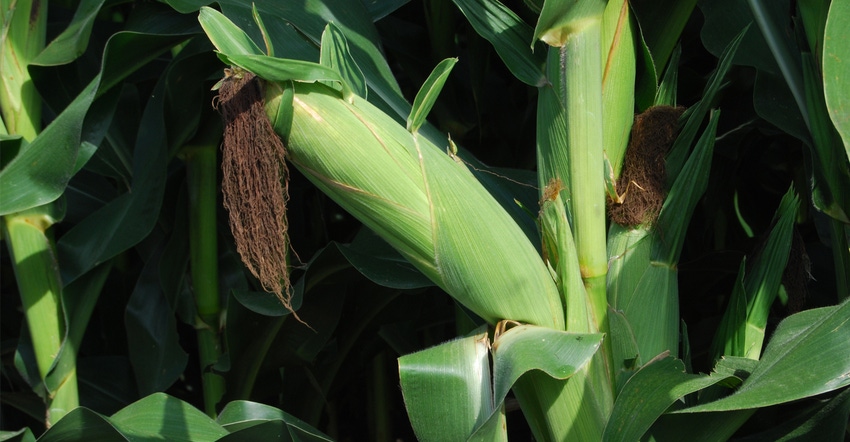
Nearly all the corn crop has begun to silk at 96% statewide. The corn crop is now 59% in dough stage, 12 days behind last year and nine days behind the five-year average. And 7% of the corn has reached the dent stage, two weeks behind last year and 10 days behind average. Corn condition is rated 65% good-to-excellent.
Iowa’s soybean crop is 93% started to bloom, two weeks behind last year and 10 days behind average. And 71% of the crop has started setting pods, 17 days behind last year and nearly two weeks behind average. Soybean condition declined slightly from the previous week to 61% good-to-excellent.
Oats harvested for grain has almost wrapped up at 97% complete statewide. Second cutting of alfalfa hay is nearly complete at 96%. Third cutting of alfalfa hay reached 36%, nine days behind average. Hay condition rates 55% good-to-excellent.
Pasture condition declined for the seventh straight week and now rates a season low 42% good-to-excellent. Pasture regrowth has been slow and supplemental hay feeding has been used due to drier-than-normal pasture conditions. Some livestock have struggled with continued temperature fluctuations.
Weekly weather summary
“After a three-week stretch of drier-than-normal conditions across the state, portions of southern and western Iowa received above-average rainfall for the week ending Aug. 18,” says Justin Glisan, state climatologist with the Iowa Department of Agriculture. “The rest of the state was near normal.”
Temperatures were slightly cooler than average, with departures of 1 to 2 degrees below average across Iowa. The statewide average temperature was 70.9 degrees, 1.3 degrees below normal, says Glisan, who provides the following report.
A low-pressure system continued to move across Iowa on Sunday (Aug. 11), bringing measurable rainfall. There were locally heavy downpours with a stronger line of storms in southwest Iowa. Cloudy conditions kept temperatures below average, generally in the upper 70s to low 80s.
A second low-pressure system moved through Iowa early on Monday bringing another wave of thunderstorms. As of 7 a.m., over 35 stations reported totals above an inch with Oakland (Pottawattamie County) reporting the highest 24-hour total of 2.82 inches.
The system cleared the state overnight into Tuesday with lows in the mid to upper 60s. Dense fog was reported in central Iowa. Isolated strong storms clipped Iowa’s northeast corner during the evening hours leaving behind rain totals ranging from 0.30 inch in Dubuque (Dubuque County) to 0.71 inch in Decorah (Winneshiek County).
A weak cold front dropped through Iowa early Wednesday producing unseasonably cool but pleasant conditions. Statewide average high was 75 degrees, 8 degrees below average. Isolated showers formed over the Great Lakes, bringing light rain across eastern Iowa. Totals were generally under a 10th of an inch.
Cooler conditions prevailed Thursday (Aug. 15) under partly to mostly sunny skies. Highs stayed in the upper 70s and low 80s. Daytime temperatures on Friday remained seasonal with a light variable wind. Rain moved into southern Iowa Saturday morning along with isolated storms during the day. Chariton (Lucas County) had 0.95 inch of rain.
A squall line ahead of a cold front brought much needed rain to Iowa on Saturday night into Sunday morning. Totals across the state were above 1 inch at over 60 stations, with isolated 2-inch totals at several stations. There were also reports of a brief tornado in Rock Rapids (Lyon County) and in Grand Mound (Clinton County). Several severe straight-line wind events were reported in northwest Iowa.
Weekly rain totals ranged from 0.24 inch in Charles City (Floyd County) to 4.97 inches in Atlantic (Cass County). Statewide weekly average rainfall was 1.45 inches, while the normal is 0.98 inch.
The week’s high temperature of 89 degrees was reported on Aug. 13 in Donnellson (Lee County) and Keosauqua (Van Buren County), on average 3 degrees above normal. Cresco (Howard County) reported the week’s low temperature of 50 degrees on the Aug. 15, 7 degrees below average.
You May Also Like


