August 13, 2019
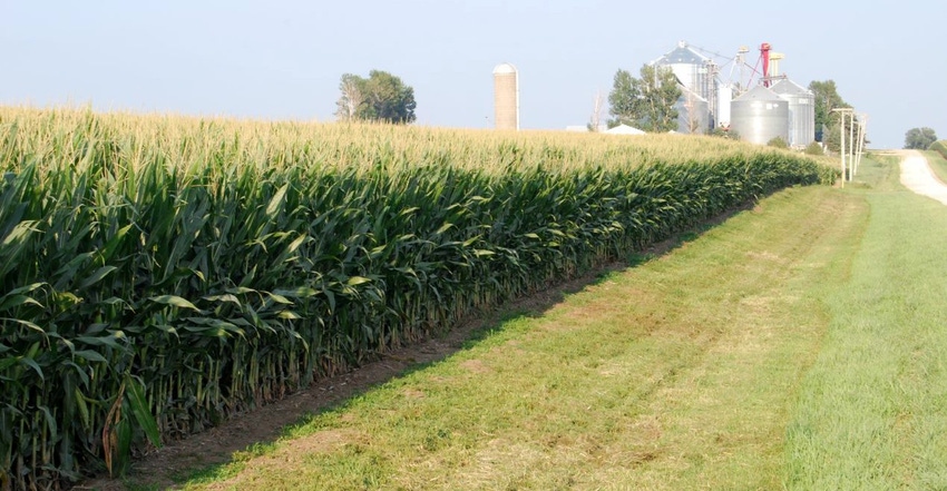
Iowa continued to have dry field conditions across most of the state last week. East-central, south-central and southeast Iowa reported the driest topsoil and subsoil moisture supplies. The latest weekly USDA survey based on data gathered Aug. 11 shows the statewide average for subsoil moisture at 4% very short, 23% short, 70% adequate and 3% surplus.
Iowa’s 2019 corn and soybean crops are in pretty good shape overall, although development lags behind normal due to this year’s delayed planting. “We’re hoping for a later-than-normal frost this fall,” says Duane Aistrope, farming in Fremont County in southwest Iowa. With only 81% of its corn in silking stage as of last week, Southwest Iowa is the area of Iowa furthest behind. Statewide, the corn crop is now 92% in silking stage, nearly two weeks behind the five-year average.
"Overall for Iowa, crops around the state are in good condition. Last week, seasonal temperatures helped mitigate some crop stress in regions of Iowa that received below-average rainfall," notes Iowa Secretary of Ag Mike Naig. "I'm also hearing reports of thistle caterpillars and gray leaf spot, so I encourage farmers to scout their fields."
Like Iowa, the U.S. corn and soybean crop growth stages are still running well behind averages. The overall condition of the corn crop in the 18 major corn-producing states is now rated 57% good-to-excellent, same as a week ago. USDA says 90% of the nation’s corn crop is in silking stage, compared to a 97% five-year average. And 39% of the corn has entered dough stage, versus a 61% five-year average. USDA rates 7% of the U.S. corn in dent stage, versus a 16% five-year average.
The complete weekly Iowa Crop Progress and Condition Report is available on USDA’s site at nass.usda.gov/ia.
Crop report
Iowa farmers continued to have abnormally dry field conditions across most of the state during the week ending Aug.11, according to USDA’s National Ag Statistics Service. Statewide there were 5.9 days suitable for fieldwork. Activities included spraying fungicides and insecticides and harvesting hay and oats.
Topsoil moisture rated 7% very short, 29% short, 62% adequate and 2% surplus. East-central, south=central and southeast Iowa reported topsoil moisture conditions as over 55% short to very short. Subsoil moisture rated 4% very short, 23% short, 70% adequate and 3% surplus.
As of Aug. 11, 92% of the Iowa corn crop has begun to silk, 17 days behind last year and nearly two weeks behind the five-year average. Also, 41% of the crop has reached dough stage, 10 days behind last year and eight days behind average. One percent of the crop statewide reached the dented stage. Corn condition rated 65% good-to-excellent.
Looking at Iowa’s soybean crop, 87% has started to bloom, 15 days behind last year and 12 days behind average. The survey shows 56% of the crop has started setting pods, also 15 days behind last year and 12 days behind average. Soybean condition rated 63% good-to-excellent.
Iowa’s oat crop is 89% harvested for grain, two days behind both last year and average. The second cutting of alfalfa hay reached 92%, five days behind average. The third cutting of alfalfa hay reached 25%, one week behind average. Hay condition declined to 57% good-to-excellent. Pasture condition declined for the sixth straight week and rated a season low 46% good-to-excellent. There were no major livestock issues reported.
Weekly weather summary
“Unseasonably dry conditions continued for the third consecutive week across most of Iowa during the week ending Aug.12,” says Justin Glisan, state climatologist with the Iowa Department of Agriculture. “The southwest two-thirds of the state reported rainfall deficits between 0.50 to 1 inch. Temperatures were generally seasonable with departures of 1 to 2 degrees above average in western Iowa and 1 to 2 degrees below average in eastern Iowa. The statewide average temperature last week was 72.8 degrees, 0.80 degrees above normal.”
The week began with partly to mostly sunny conditions over Iowa on Aug. 4, says Glisan, who provides the following report.
High temperatures reached the mid-80s. Isolated thunderstorms popped up in north-central Iowa during the early morning hours of Monday. A line of strong thunderstorms sped through much of Iowa’s eastern half during the afternoon and into the night.
Some storms produced severe straight-line winds in northern Iowa. An EF-1 rated tornado was reported southwest of Dubuque (Dubuque County), causing damage to corn, trees and houses along its path. Much of the northeastern two-thirds of Iowa had measurable rainfall; totals ranged from 0.01 inch in Lowden (Cedar County) to 1.68 inches in Stanley (Buchanan County), with the statewide average rainfall at 0.28 inch.
Tuesday and Wednesday were quiet as a high-pressure system sat over the Midwest. Parts of western Iowa received light rain on both days, with totals under a 10th of an inch. Highs were in the low to mid-80s, a degree or two warmer than average.
Isolated showers and thunderstorms popped up in central Iowa Aug. 8, with a brief downpour on the opening ceremonies of the 160th annual Iowa State Fair in Des Moines (Polk County); a total of 0.22 inch was reported near the fairgrounds. Higher rain totals were in east-central Iowa with Newton (Jasper County) reporting 0.42 inch and Montezuma (Poweshiek County) getting 0.40 inch.
Pleasant conditions returned to the state Thursday afternoon and into Friday as a weak cold front pushed out of southern Iowa. Highs were in the upper 70s across northeast Iowa while the rest of the state experienced the 80s. Rain pushed into northwest Iowa Friday evening and into Saturday morning. Additional thundershowers popped up in north-central Iowa and moved east in two rounds into the afternoon. Daytime temperatures were slightly warmer than average, generally in the mid to upper 80s.
Iowa rainfall half of normal
Showers and storms moved into southwest Iowa Sunday (Aug. 11) morning. Rain totals, reported at 7 a.m. for the previous 24-hours, were mostly under an inch and in the range of a tenth to a half-inch. Underwood (Pottawattamie County) reported 1 inch.
Weekly rainfall totals ranged from no accumulation at multiple stations within a band across south-central Iowa to 2.87 inch in Eagle Grove (Wright County). Statewide weekly average precipitation was 0.49 inch while normal is 0.96 inch. The week’s high temperature of 92 degrees was reported on July 5 in Muscatine (Muscatine County), 7 degrees above average. Cresco (Howard County) reported the week’s low temperature of 49 degrees on Aug. 9, which was 9 degrees below average.
About the Author(s)
You May Also Like


