September 24, 2019

A few farmers in central Iowa began harvesting corn for grain last week. But you can’t quite say corn harvest 2019 is underway yet. Statewide, only 18% of the 2019 Iowa corn crop has reached maturity as of Sept. 22, according to USDA’s weekly survey. That’s 19 days behind last year and two weeks behind average.
“This crop still has a way to go to reach full maturity and then, hopefully, dry down in the field,” says Bill Meade, a Davis County farmer. “In our area of southeast Iowa, we had 2 inches of rain over the weekend. It’s better that it rains now rather than 30 days from now. That is, as long as the faucet shuts off to at least let us get started with harvest.”
“Wet conditions along with unseasonably warm temperatures continued across Iowa last week,” notes Iowa Agriculture Secretary Mike Naig, commenting on the weekly USDA report. “Farmers in some pockets of central and west-central Iowa have started harvesting, but we’re still about a week away from widespread harvest.”
Nationwide, USDA estimates the U.S. corn harvest is now 7% complete, versus 11% for the five-year average for this time of year. USDA rates this year’s U.S. corn crop in the mature stage at 29%, versus 57% for the five-year average.
The complete weekly Iowa Crop Progress and Condition Report is available on USDA’s site at nass.usda.gov.
Crop report
Another week of heavy rainfall across Iowa allowed just 3.3 days suitable for fieldwork statewide during the week ending Sept. 22, according USDA’s National Ag Statistics Service. Fieldwork activities included harvesting hay and seed corn, chopping silage, and seeding cover crops.
Topsoil moisture condition is rated 1% very short, 7% short, 75% adequate and 17% surplus. Rain this past week helped increase topsoil moisture levels in all of Iowa’s nine crop reporting districts; however, the southeast district remains the driest, with a topsoil moisture rating of 36% short to very short. Subsoil moisture for Iowa statewide is rated 2% very short, 9% short, 79% adequate and 10% surplus.
Nearly all of Iowa’s 2019 corn crop as of Sept. 22 was in or beyond dough stage at 97% complete statewide, over two weeks behind the five-year average. And 82% of the crop has reached dented stage or beyond, 17 days behind last year and 12 days behind average. Eighteen percent of Iowa’s corn has reached maturity, 19 days behind last year and two weeks behind average. There were a few reports of farmers in central Iowa harvesting corn for grain this past week. Iowa’s corn condition is rated 65% good-to-excellent.
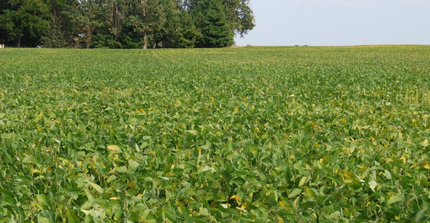
For Iowa’s soybean crop, the survey shows 65% has begun coloring or is beyond coloring, 11 days behind last year and eight days behind average. And 22% of the crop has begun dropping leaves, 12 days behind last year and nine days behind average. There were a few reports of soybeans being harvested in west-central and central Iowa. Soybean condition is rated 62% good to excellent.
The third cutting of alfalfa hay reached 87% complete as of Sept. 22, just over a week behind average. Pasture condition is rated 43% good-to-excellent. Continuous rainfall this past week caused feedlots to become muddy.
Weekly weather summary
Unseasonable warmth and wetness prevailed across Iowa last week. Above-average rain fell across the state with portions of Iowa getting up to 3 inches more than normal. It was also the warmest week for Iowa since the week ending July 22. Statewide average temperature last week was 73.6 degrees, 12.9 degrees warmer than usual.
This summary for the week ending Sept. 22 comes from Justin Glisan, state climatologist with the Iowa Department of Ag. He provides the following daily report.
Thunderstorms cleared southeast Iowa by Sunday (Sept. 15) afternoon as a high-pressure system moved into northern Iowa. Skies cleared through early evening as unseasonable warmth blanketed the state. Highs reached into mid to upper 80s F, with the statewide average high of 86 degrees, 11 degrees above normal. Monday was another warm and dry day under sunny skies with southerly winds. Highs reached into the low 90s across multiple stations in southern Iowa.
Overnight lows into Tuesday were well above average, remaining in the upper 60s and low 70s. Parts of northwest Iowa were up to 26 degrees above average. Statewide average low was 65 degrees, 15 degrees above average. Showers started to pop up in northwest Iowa ahead of a warm front just after midnight on Wednesday.
The narrow band of thunderstorms moved into eastern Iowa during the afternoon. The line fell apart during the evening hours, with isolated stronger storms popping up in east-central Iowa. A new complex of storms pushed into Iowa just before midnight.
Two-day rain totals at 7 a.m. Thursday showed most of Iowa received measurable rainfall. Highest amounts were in Northeast Iowa with 30 National Weather Service stations reporting over an inch; Osage (Mitchell County) had 3.45 inches, with the statewide average rainfall at 0.74 inch.
Another line of storms formed across northern and eastern Iowa early Friday morning and slowly moved east. The line gradually dissipated near the Iowa-Illinois border by noon. Conditions the rest of the day were unseasonably warm under sunny skies. Highs reached into mid-to-upper 80s, with the statewide average high hitting 84 degrees, 11 degrees above normal.
Clouds pushed into Iowa overnight into Saturday, holding overnight temperatures in the low 70s, up to 24 degrees above average. Cloudy conditions persisted throughout the day as showers and thunderstorms moved into southern Iowa. The complex moved out of the state during the evening. Stronger storms ahead of a low-pressure system moved into southwest Iowa and expanded across much of Iowa’s western half.
Rain expanded into eastern Iowa through early morning hours of Sunday. Rain totals at 7 a.m. were largest in southern Iowa, with nine stations reporting 2 inches or more. Centerville and Rathbun Dam (Appanoose County) received 3.6 inches and 2.7 inches, respectively.
Weekly rain totals ranged from 0.02 inch in Hawarden (Sioux County) to 4.71 inches at Nora Springs (Floyd County). Statewide weekly average rainfall was 1.74 inches, while normal is 0.77 inch.
The week’s high temperature of 93 degrees was reported on Sept. 15, 17 and 18 at multiple stations in south-central Iowa. This reading was on average 17 degrees above normal. Britt (Hancock County) and Forest City (Winnebago County) had the week’s low temperature of 52 degrees on Sept. 16, 2 degrees below normal.
About the Author(s)
You May Also Like


