June 25, 2019

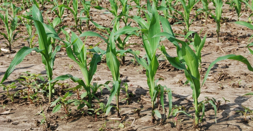
Iowa’s 2019 corn crop is rated 62% in good-to-excellent condition, according to USDA’s statewide survey for the week ending June 23. The state’s soybean crop is rated 63% good-to-excellent, also an improvement from the previous week’s report.
A cool, wet weather pattern persisted across much of Iowa last week. “Now that most farmers in Iowa are done planting, warmer temperatures are needed to help the crops catch up,” says Greg Thessen, regional director of USDA’s National Ag Statistics Service office in Des Moines, which conducts the survey. This year for the week ending June 23, Iowa’s corn crop is 96% emerged and soybeans are 81% emerged statewide. Usually, 100% of the Iowa corn crop is emerged by now and 96% of the soybeans.
“With this very wet spring and delayed planting, planting dates for corn and beans are spread out from late April to late June around here,” says Mark Messenger, a Webster County farmer. “And there are some prevented planting acres. It’s the most challenging spring I’ve ever had, farming for the past 30 years.”
Concerned about nitrogen loss with all the rain, he’s applying N to some of his corn as a sidedress this week.
Iowa doing better than U.S.
Iowa is faring better than some other key Midwest crop-producing states, Thessen says. Ohio’s corn crop is only 39% good-to-excellent; Indiana is 43%; Illinois is 47%. Nebraska’s corn crop, however, is rated 77% good-to-excellent as of June 23.
USDA pegs this year’s U.S. corn crop at 56% in good-to-excellent as of June 23, slightly below the previous week’s 59% rating. The nation’s soybean crop is rated 54% good-to-excellent, versus a 73% rating a year ago. The U.S. soybean crop is now 85% planted, versus 97% for a five-year average. Only 71% of the U.S. soybean crop is now emerged, running significantly behind the five-year average of 91%.
The complete weekly Iowa Crop Progress and Condition Report is available on USDA’s site at nass.usda.gov/ia.
Crop report
It was another wet week as showers and thunderstorms moved through the state during the seven days ending June 23. It meant Iowa farmers had limited opportunities for fieldwork during the week, according to USDA’s National Ag Statistics Service. Statewide, there were just 3.1 days suitable for fieldwork. Activities included planting, harvesting hay, spraying and applying nitrogen.
Topsoil moisture rated 0% very short, 1% short, 68% adequate and 31% surplus. Subsoil moisture rated 0% very short, 1% short, 62% adequate and 37% surplus.
Iowa’s 2019 corn crop is now 96% emerged, two weeks behind last year and 15 days behind the five-year average. Corn condition improved to 62% good-to-excellent. Iowa’s expected soybean crop for this year is now 95% planted, two weeks behind average. The survey shows 81% of the bean crop has emerged, two weeks behind last year and two weeks behind average. Soybean condition rated 63% good-to-excellent, also an improvement from the previous week’s report.
Oats headed reached 58% as of June 23, eight days behind last year and eight days behind average, while 3% of the crop has started coloring. Oat condition rated 63% good-to-excellent. Wet conditions slowed progress on the first cutting of alfalfa hay with just 73% of the crop harvested statewide, nearly two weeks behind average. Hay condition rated 66% good-to-excellent. Pasture condition continued to improve and rated 69% good-to-excellent. Feedlots were muddy after recent rainfalls.
Weekly weather summary
An unsettled and active weather pattern across the Midwest brought multiple days of showers and thunderstorms across Iowa during the week that ended June 23. The western two-thirds of Iowa received above-average rainfall, while the northeast corner was slightly drier than average. Unseasonable coolness continued across the state. For the week, temperatures averaged 67.2 degrees F, 4.1 degrees below normal.
To start the week, a warm front across central Iowa mid-afternoon Sunday (June 16) set up a stark temperature contrast. Eastern Iowa had highs in the mid-to-upper 60s, around 10 to 15 degrees below average. Temperatures across western Iowa reached the low-to-mid 80s, near normal for June. A cold front moved through on Monday, bringing measurable rainfall across Iowa’s northwestern third. Slow-moving storms brought locally heavy amounts; rain totals ranged from 0.25 to over 1.50 inches; Pocahontas (Pocahontas County) reported 1.60 inches, 1.43 inches above average.
The cold front continued to move through Iowa on Tuesday with measurable rain across much of the state. Isolated thunderstorms fired in Iowa’s southwest corner; Atlantic (Cass County) and Randolph (Fremont County) reported 24-hour totals of 1.58 and 1.84 inches, respectively. High temperatures ranged from the upper 70s to low 80s in southern Iowa and 70s across the rest of the state. The average statewide high was 74 degrees, 8 degrees below normal.
A weak low-pressure system moving through northern Missouri brought showers to southern Iowa early on Wednesday. Additional development over central and southeast Iowa during the afternoon and evening hours brought locally heavy rain to stations across three counties in extreme southeast Iowa. Salem (Henry County) reported 2.74 inches while Keokuk Lock and Dam (Lee County) observed 1.77 inches.
A stagnant low-pressure system sat over the Midwest on Thursday, bringing waves of showers through the weekend. Isolated showers and thunderstorms moved through Iowa Thursday morning and afternoon. Western Iowa had the highest totals with Sac City (Sac County) getting 2.4 inches, 2.21 inches above average. High temperatures remained cooler than average under cloudy skies, generally in the 70s statewide.
Friday started off very wet as a line of strong storms sped across the state, leaving measurable rainfall at most stations. A second round of storms moved through southern Iowa in the late night into Saturday. Rain totals at 7 a.m. were highest in central Iowa, with Des Moines Airport (Polk County) reporting 2.41 inches. Locations east and west had totals between 0.20 to 1 inch; 20 stations reported over an inch, with the statewide average at 0.45 inch, 0.28 inch above average.
The remainder of Saturday was cool and wet across much of Iowa with highs in mid-to-upper 70s, 6 degrees below normal. Thunderstorms moved into southwest Iowa during late afternoon and into central and eastern Iowa during the late evening hours. Some locations received torrential downpours and flash flooding in central Iowa. There were also a few reports of severe hail and high winds. The system slowly moved through Iowa into Sunday morning. Rain totals ranged from 0.01 inch in Sac City to 1.98 inches in Des Moines.
Weekly rainfall totals ranged from 0.23 inch at Cresco (Howard County) to 5.01 inches in Allerton (Wayne County). Statewide average was 1.73 inches, while normal is 1.17 inches. The week’s high temperature of 86 degrees was in Oakland (Pottawattamie County) on Monday, 4 degrees above normal. Cedar Rapids (Linn County) had the week’s low temperature of 49 degrees on Tuesday, 12 degrees below average.
About the Author(s)
You May Also Like


