August 27, 2019
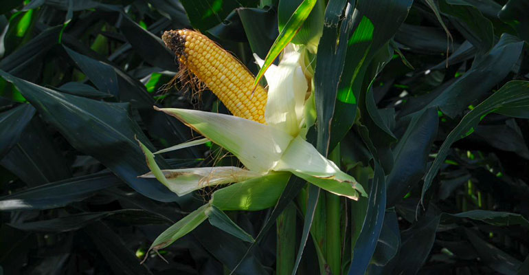
Dennis Stratmann looks out at his green cornfields, which are lagging about 10 to 12 days behind normal in maturity this summer. “We are going to need a later than normal frost this fall,” says the Hartley, Iowa farmer. “We planted corn and soybeans later than usual due to the wet spring, and they just can’t catch up to where they should be in maturity for this time of year.”
Rainfall across most of Iowa last week was very welcome. USDA’s weekly statewide crop conditions survey as of Aug. 25 shows soil moisture is 75% adequate for most of the state, and 2% is surplus. Only 20% of Iowa is running a little short of normal for subsoil moisture supply.
"Recent temperatures have been cooler than normal," says Mike Naig, Iowa secretary of agriculture. "The good news is the initial fall weather outlook from the National Weather Service suggests warmer-than-normal temperatures in September, October and November, which will benefit farmers during harvest."
While 65% of Iowa’s corn is rated good to excellent, and 62% of the beans are enjoying that favorable rating, the U.S. crop isn’t doing as well. The overall condition of the nation’s corn crop for 2019 is now rated 57% good to excellent, slightly above the 56% of a week ago and below the 68% of a year ago. The U.S. soybean crop is rated 55% good to excellent, compared to 53% a week ago and 66% a year ago.
The complete weekly Iowa Crop Progress and Condition Report is available on USDA’s site at nass.usda.gov/ia.
Crop Report
Rain across most of Iowa improved dry soil conditions during the week ending Aug. 25, according to USDA’s National Ag Statistics Service. Statewide, there were 5 days suitable for fieldwork. Reporters throughout Iowa mentioned the need for warmer weather as cooler-than-normal temperatures have slowed crop development. Fieldwork activities included spraying fungicides and insecticides on late planted crops and harvesting hay.
Topsoil moisture condition rated 3% very short, 20% short, 75% adequate and 2% surplus. Northwest Iowa was the only district where topsoil moisture condition became drier this past week. Subsoil moisture condition was rated 4% very short, 20% short, 74% adequate and 2% surplus.
The survey shows 76% of Iowa’s corn crop has reached the dough stage, 11 days behind last year and 9 days behind the 5-year average. And 21% of the crop has reached the dented stage two weeks behind last year and 9 days behind average. Corn condition is rated 65% good to excellent.
Nearly all the soybean crop has started to bloom at 96% statewide, 11 days behind average. And 84% of the crop has started setting pods, 17 days behind last year and 12 days behind average. Soybean condition is rated 62% good to excellent.
The third cutting of alfalfa hay reached 49% complete, 11 days behind average. Hay condition is rated 57% good to excellent. Pasture condition improved slightly for the first time in 7 weeks and is rated 44% good to excellent. There were no reported livestock issues this past week.
Weekly Weather Summary
Wetter-than-average conditions continued across central and southern Iowa during the week that ended Aug. 25. Locations in northeast Iowa were drier, with rainfall deficits up to and slightly over an inch. Unseasonable coolness also persisted, with temperatures reaching 5 degrees below average across parts of Iowa. The statewide average temperature was 68.5 degrees, 3.1 degrees below normal.
“That sums up the weather in Iowa for last week,” says Justin Glisan, state climatologist with the Iowa Department of Agriculture.
A low-pressure system moved out of Iowa during the afternoon on Sunday (Aug.18), leaving measurable rainfall across the southern half of the state. Northwest winds and partly cloudy conditions kept high temperatures in the low-to-mid 70s in northern Iowa and low 80s in the south. Rain totals reported at 7 a.m. on Monday (Aug. 19) were heaviest in southeast Iowa with Ottumwa (Wapello County) observing 0.92 inches. Widespread totals between 0.10 inch and 0.25 inch were also reported.
Conditions during the day on Monday were warm and humid, with highs in the mid-80s and variable winds. Daytime conditions created an unstable atmosphere primed for overnight storms. Thunderstorms began to fire before midnight in north-central Iowa. These storms quickly turned severe and the system moved southeast through central Iowa into the morning hours of Tuesday.
Along with multiple severe straight-line wind events, three tornadoes were reported. Two tornadoes, one hitting Tracy (Marion County) and the other moving through Badger Creek State Park (Madison County), were rated EF-1, with peak winds estimated at 110 mph. A strong EF-3 rated tornado, with estimated winds of 150 mph, caused substantial damage to several structures in Lacona (Warren County). Over 100 stations reported an inch or more of rain. In locations with stronger storms, rain totals varied from 2 inches in Eldora (Hardin County) to 4.3 inches in Coon Rapids (Carroll County). The statewide average was 0.75 inch of rainfall.
Another low-pressure system moved through Iowa on Wednesday (Aug. 21), bringing additional widespread rain to much of the state. Totals were highest across central and southern Iowa. Pella (Marion County) received 2.22 inches; Rathbun Dam (Appanoose County) reported 2.10 inches.
Near-perfect weather to end week
Iowa experienced near-perfect weather conditions Thursday (Aug. 22) and Friday (Aug. 23) as a large dome of high pressure dominated the upper Midwest, bringing clear and comfortable conditions. Daytime highs were in the mid-to-upper 70s with unseasonably cool overnight lows in the mid to upper 50s, on average five degrees below normal. Pleasant and dry conditions continued through the weekend with partly cloudy skies and a light southeasterly wind on Saturday. Temperatures remained in the mid-70s with low relative humidity. Overnight lows into Sunday (Aug. 25) dipped into the upper 50s to low 60s as cloud cover began to increase across Iowa.
Weekly rainfall totals ranged from no accumulation in Decorah (Winneshiek County) to 4.47 inches in Guthrie Center (Guthrie County). The statewide weekly average rainfall was 1.12 inches, slightly above the normal of 0.98 inch. The week’s high temperature of 92 degrees F was reported Aug. 20 at Little Sioux (Harrison County) and Oakland (Pottawattamie County), on average 9 degrees above normal. Cresco (Howard County) had the week’s low temperature of 47 degrees on Aug. 22, 9 degrees below average.
About the Author(s)
You May Also Like


