Subscribe to receive top agriculture news
Be informed daily with these free e-newsletters

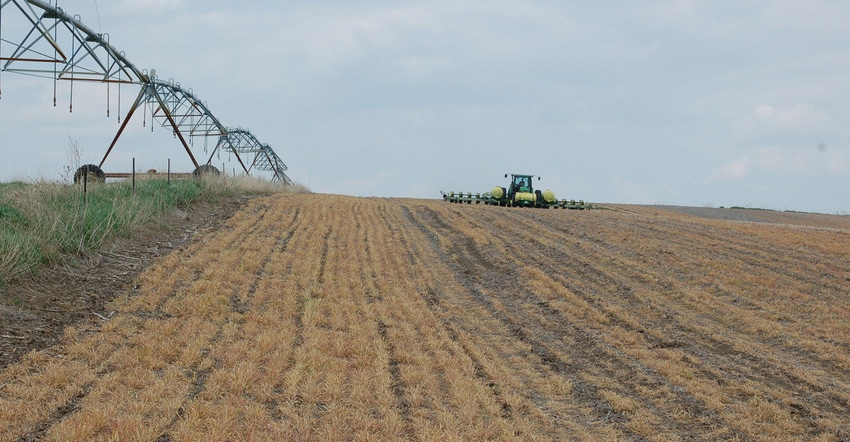
Resilient Ag Landscapes: Planting cover crops is a proven tool for adapting to extreme weather events.
November 3, 2017
In previous Resilient Ag Landscapes columns, we've discussed the ongoing challenge of adapting to more extreme weather events in Nebraska.
One of the most often discussed tools for doing this is seeding cover crops. Whether it's breaking compaction, using excess water, improving infiltration, building soil organic matter, slowing soil erosion or even sequestering excess nitrogen, cover crops have been used in a number of applications to adapt to extremes. However, one of the biggest hang-ups producers have is getting past a corn-soybean rotation.
"It comes down to economics,” says Keith Glewen, Nebraska Extension educator. “That's part of our problem. You have growers that won't consider wheat or another crop other than corn or beans — so what can they do? Cover crops are one thing."
Cost is a factor for growers in planting cover crops — especially if it's their first time. Nathan Mueller, Nebraska Extension cropping systems educator, says it's also important to remember that not every acre needs to be covered, and precision ag technology and strategic planning can help use cover crops where they're best-suited. "It's getting in the mindset of certain fields are benefiting more than others rather than planting all or nothing," Mueller says.
Precision technology like yield maps, soil electrical conductivity (EC) maps, or near-infrared maps can be a valuable tool in figuring out certain parts of a field that need more improvement than others in organic matter, according to Mueller.
"Maybe you don't need a cover crop if you're looking at cutting costs,” Mueller. says “You could always do a prescription cover crop if you're looking at an eroded part of the field. For erosion control you only need a cover crop in a portion of the field.
"A couple farmers here are just seeding cover crops where water runs and there's gully erosion. After soybeans come out they're drilling just in parts of the field where they think it's going to be the most beneficial. That's just due to visible erosion."
While some are concerned cover crops will use moisture that could be used by the following cash crop, Mueller notes that on sandy soils like those found in northeast Nebraska, and where ample rain typically falls in April and May, water tends to be lost to deep percolation anyway. Cover crops could potentially help hold more water by building organic matter and root structure, and preventing water from being lost to evaporation.
Meanwhile, cover crops can also be used to target areas of a field with poorly-drained soils.
"If you have poorly drained area and cover crops can use water on purpose, that might help you get in the area to plant where it's likely to use an inch or two out of the profile” Mueller says. “On poorly drained pothole areas, if I wanted to I could just seed those areas to drain water on purpose. I think there are options where you could plant cover crops on portions of the field and just end rows."
Perennial grass strips or buffer strips are another tool which help slow runoff while providing habitat for wildlife and pollinators, but present another obstacle to farm around — and that's a problem for chemical applicators. However, Glewen adds that precision ag can play a role here too.
"We don't have to make the decision on the last nozzle on that perennial grass area” he says. “We have precision ag tech that knows for a fact that last nozzle isn't on over the perennial grass strip.” "What used to be an excuse is no longer an excuse — it just takes a willingness to make an effort to understand precision ag technology and make it work for you."
For example, automatic section control can be used to shut specific nozzles off automatically while driving over perennial grass strips, field edges or any other sensitive area.
"The way that system works is it's recording where it's sprayed in the field and it shuts off the section as it passes back over those areas," says Joe Luck, Nebraska Extension precision agriculture engineer. "You can usually incorporate coverage maps like boundaries if you have a software package where you could draw that boundary and upload it to the monitor. You could draw grass waterways within the field or even on the edge of the field and designate those as no-spray zones."
Luck notes research conducted by the University of Kentucky has shown up to 25% reduced overlap for oddly-shaped fields with several conservation structures. Meanwhile, even square-shaped fields with few conservation structures could see a 2% to 5% reduction of overlap.
That same technology can be used on planters to plant around those structures, Luck adds. "There's the complete ability to farm around those structures if we don't want to," he says. "It eliminates some of the excuses we've had in the past for not implementing those conservation structures."
You May Also Like
Current Conditions for
51°F
Partly Sunny
Day 52º
Night 36º
Enter a zip code to see the weather conditions for a different location.


