Subscribe to receive top agriculture news
Be informed daily with these free e-newsletters

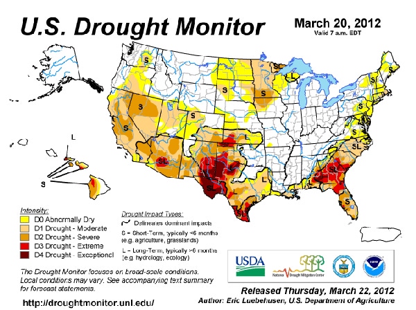
It’s still officially dry in Texas.While scientists have determined 2011 was the driest year on record, economists estimate it was also the costliest drought ever recorded.Rains throughout the state over the last two months seem to have improved prospects for some, but soil moisture profiles are still short.
March 22, 2012
Even with recent rains, it’s still officially dry in Texas. Soil scientists from the USDA-Natural Resources Conservation Service (NRCS) have collected data that supports record breaking low precipitation not only for the 2011 calendar year but also for the last 12 month period on the Southern High Plains – one of the state’s top agriculture producing areas.
The rich, fertile soils in this area make it ideal for farming, but the extended drought has had long-lasting impacts on the agriculture industry.
“Rainfall deficits coupled with high temperatures and excessive winds during the early part of the 2011 growing season contributed to the severity of the drought,” says Craig Byrd, NRCS soil survey project leader in Lubbock.
While scientists have determined 2011 was the driest year on record, economists estimate it was also the costliest drought ever recorded. Texas AgriLife Extension estimates the agriculture industry, which is the state’s second largest industry, suffered a $7.62 billion loss. This is more than $3.5 billion higher than the 2006 drought loss estimates, which previously was the costliest drought on record.
The Southern High Plains is the state’s top cotton-producing area. The cotton industry alone lost $2.2 billion in 2011. The Southern High Plains is also a top producer for corn, wheat and sorghum. The state’s grain industry lost a combined total of $1.4 billion, according to recently released information from Texas AgriLife Extension.
The 2011 rainfall data for the Southern High Plains was collected through the Soil Climate Analysis Network (SCAN) stations at six monitoring sites located at Willow Wells and Crossroads, New Mexico, and Lehman, Levelland, and Lubbock (Reese Center), Texas, through the National Water and Climate Center.
Since January 2011, rainfall totals recorded at the SCAN locations ranged from 2.68 to 4.07 inches of precipitation. Normally this range should be somewhere between 15.3 to 17.9 inches for the region.In 2011 the cumulative rainfall total for Lubbock (Reese Center) is 2.94 inches. The 30-year average is normally 17.3 inches for Lubbock at this time of year. Cumulative rainfall over the last 12 months at Lubbock (Reese Center) totals 4.25 inches, which Byrd says undoubtedly qualifies this as a historical drought.
According to Byrd, another factor adding to the severity of the drought during the 2011 growing season was record breaking high temperatures during the months of June through August. The daily temperature average at Lubbock was 83.4 degrees Fahrenheit where the 30-year average is normally 78.7 degrees. The daily high temperature at Lubbock during this same period was 97.8 degrees and the 30-year average is normally 91.0 degrees.Many daily high temperatures reached well over 100 degrees for several consecutive days during this period as well.
Although spring winds are not unusual for the High Plains of Texas, the excessive heat combined with high winds was a mixture that also contributed significantly to the depletion of what little moisture was retained in the soil. During this period wind speeds averaged daily about 9.7 miles per hour during the months of April, May, and June, which is higher than most years. Peak wind speeds during this period were in excess of 40 miles per hour.
Throughout the year the percent plant available soil moisture was extremely low. Soil moisture levels are measured at the SCAN sites as a water volume fraction and multiplied by 100 and shown as a percent range. In general the 35 to 45 percent range is a very wet or saturated soil profile; 15 to 35 percent is a moist or very moist soil profile at field capacity with available plant moisture; less than 15 percent is a soil that is very dry or at permanent wilting point with no available plant moisture in the profile.
The average rooting zone for annual crops grown on the High Plains is typically between 2 and 40 inches. For a period of the year, this zone was at permanent wilting point with zero available plant moisture. Perennial plants, trees and shrubs will root to greater depths, but soil moisture levels at 60 to 80 inches range from wilting point to the low end of available plant moisture.
Rains throughout the state over the last two months seem to have improved prospects for some, but soil moisture profiles are still short. As the spring planting season is about to begin, farmers remain concerned for what the future holds.
For more information about the NRCS Soil Survey program in Texas, visit http://www.tx.nrcs.usda.gov/soil/.
You May Also Like
Current Conditions for
51°F
Partly Sunny
Day 52º
Night 36º
Enter a zip code to see the weather conditions for a different location.


