Subscribe to receive top agriculture news
Be informed daily with these free e-newsletters

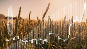
Indications are that the March through May period will see a continuation of the trend toward dry conditions with "probably below normal rainfall” from June through August.
Of factors lending themselves to predictability in weather forecasting, temperatures in the Pacific Ocean and Atlantic Ocean are proving among the most reliable, says John Nielsen-Gammon, regents professor at Texas A&M University and Texas state climatologist.
And computer simulations based on current ocean conditions point to “a slight tendency” for a continuation of below normal rainfall in Texas and across much of the Southwest for the first three months of 2013, he said at the Beltwide Cotton Conferences at San Antonio, Texas.
Indications are that the March through May period will see a continuation of the trend toward dry conditions, he says, with “probably below normal rainfall” from June through August.
For the long term, the simulations point to slightly warmer than normal temperatures, he says.
“As long as temperatures are warmer than normal in the North Atlanta, we should continue to see drier than normal summers and hotter summers,” he says. And for the longer haul, the years ahead should bring hotter, drier summers, and “more likely record warm winters and summers than cool.”
The farther-out trend, he says, is “fairly alarming” for hotter, drier summers.
Temperatures in both the Pacific and Atlantic Oceans “have been effectively working against us since 1990,” he says. “These periods tend to last 20 years to 25 years, and we’ve been in this current cycle for about 15 years, so hopefully we’re at least halfway through it.”
Many factors can affect weather, Nielsen-Gammon says — some are fairly predictable, others such as volcanic eruptions are random.
“The most reliable factor for what might happen over the next few years is what’s happening in these two oceans,” chiefly the El Niño and La Niña effects.
Going back to 1895, he says, the summer of 2011 was the hottest and driest on record in much of Texas and areas of the Southwest.
The drought devastated farmers and ranchers, and officials estimated agriculture losses at more than $5.2 billion. Hundreds of wildfires erupted in Texas and burned more than 127,000 acres, the most ever, and lake levels dropped as much as 50 feet in some lakes, while several West Texas lakes completely dried up.
Numerous Texas cities set heat records in the summer of 2011, among them Wichita Falls, which recorded 100 days of 100-degree heat, the most ever for that city. Dallas also set a record with 70 days of 100-degree heat, and the city had to close down 25 sports fields because large cracks in the ground were deemed unsafe for athletic competition.
Despite advances in climatology, he says, it’s still possible to predict weather with reasonable accuracy for only about a week in advance — “beyond that, randomness takes over.”
Following 2011’s record heat and rough, 2012 was also a drought year, Nielsen-Gammon says. After the driest 12 consecutive months on record and second driest calendar year on record, 2012 was running 0.14inchabove normal through September.
It wasn’t enough to end the drought statewide, but in many parts of Texas, especially in the eastern half, drought became “a distant memory and a distant problem,” he says. Elsewhere, reservoir levels continued to drop, but rain in most of the major metropolitan areas of the state made things seem much better.
Then, starting in the Dallas-Fort Worth area, and eventually spreading to much of the rest of the state, the rainfall stopped, and the final three months of 2012 were the third-driest October-December on record for Texas.
With 2012 ending with below-normal precipitation, the combined two-year period 2011-2012 was the fourth-driest on record, he says, topped only by 1916-1917, 1955-1956, and 1909-1910.
Although most Texans are surprised, Nielsen-Gammon says, 2012 was actually warmer than 2011. “Depending on the final tally, it will be either the warmest or second-warmest year ever, with statewide records beginning in 1895.”
You May Also Like
Enter a zip code to see the weather conditions for a different location.