July 9, 2015

Drier weather across the southern and eastern Corn Belt benefited corn, soybeans and winter wheat that had been drenched by heavy June rainfall. However, drying conditions were less than ideal due to lingering showers in the southernmost Corn Belt and below-normal temperatures. Weekly temperatures averaged at least 5° F below normal in a broad area stretching from the central Corn Belt into the Northeast.
Meanwhile, heavy rain shifted across the mid-South and interior Southeast. Weekly totals in excess of 4 inches were common in eastern Tennessee and environs, as well as several other areas. In general, Southeastern showers—in conjunction with cooler weather—eased stress on pastures and summer crops. Nevertheless, drought lingered in a few areas, mainly in the southern Atlantic States. Farther west, isolated showers peppered the Plains and Midwest, causing temporary fieldwork delays but maintaining mostly favorable conditions for summer crops.
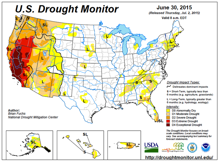
Elsewhere, monsoon-related showers dotted the Great Basin and Southwest, providing localized relief from early-season heat. However, few, if any, showers reached the Northwest, where relentless heat and increasingly dry conditions promoted a torrid crop development pace but led to worsening stress on rain-fed crops and an expansion of wildfire activity. Weekly temperatures averaged an astounding 10-20° F above normal across the interior Northwest. Heat spilled across the northern Rockies to the northern High Plains, boosting temperatures more than 10° F above normal in a few Montana locations.
You May Also Like


