
Subscribe to receive top agriculture news
Be informed daily with these free e-newsletters
August 7, 2012
During the week of July 29 – August 4, scattered showers and slightly cooler conditions provided some relief to drought-stressed summer crops—primarily soybeans—in the Corn Belt. Weekly rainfall totaled an inch or more in numerous Midwestern locations, with at least 2 inches reported in parts of the middle Mississippi and lower Ohio Valleys. Meanwhile in the Southeast, where 2- to 4-inch weekly totals were common, pastures and immature summer crops continued to benefit from widespread showers. Farther west, however, extreme heat shifted to the southern Plains. In fact, weekly temperatures averaged at least 10°F above normal—and highs topped 110°F—in an area centered on Oklahoma, where recent wildfires charred thousands of acres and destroyed dozens of homes.
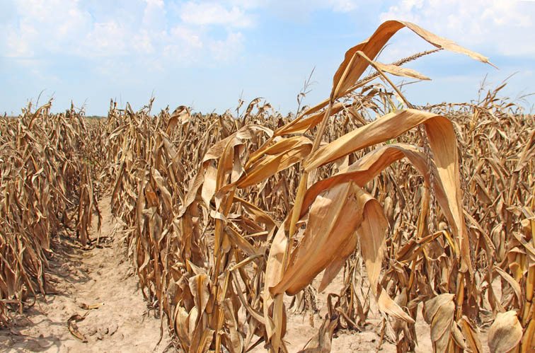
As cooler weather and scattered showers arrived across the Corn Belt late last week, Midwestern drought intensity appears to have reached a plateau. However, considerable agricultural harm has already been done. For the week ending August 5, corn and soybean conditions remain at levels unseen since 1988. For example, corn rated very poor to poor stood at 50% on August 5, a 2-point increase from week ago and just below the peak of 53% recorded in August 1988. Soybeans rated very poor to poor also increased 2 points to 39% for the second consecutive week, surpassing the 1988 benchmark of 37%.

Agricultural Weather Assessments - U.S. Corn Conditions
In addition, drought extends far beyond the Midwest, covering nearly two-thirds of the U.S. On August 5, well over half (59%) of the nation’s rangeland and pastures were rated in very poor to poor condition—a record for this statistic during the 18-year period of record. Indeed, recovery from this summer’s extraordinarily hot, dry weather will be a lengthy process, requiring the change of seasons and multiple soaking rainfall events—not just occasional showers.
Weather Outlook: Currently, extreme heat has shifted into parts of the western U.S., while dry weather has returned to the Midwest. A slow-moving cold front will cross the Midwest during the next several days, resulting in scattered showers and thunderstorms from August 7-10. In the front’s wake, rather cool air will hold late-week Midwestern temperatures mostly below 80°F. In contrast, triple-digit (100°F) readings will remain a threat through week’s end across the High Plains and the south-central U.S., as well as lower elevations of the West.
Visit www.usda.gov/drought for the latest information regarding USDA’s Drought Disaster response and assistance.
Brad Rippey, USDA Meteorologist, Office of the Chief Economist
You May Also Like
Enter a zip code to see the weather conditions for a different location.


