Subscribe to receive top agriculture news
Be informed daily with these free e-newsletters

A cold, wet spring is likely to slow and/or delay planting in much of the East and Northeast.
Swinging her "Polar Vortex," Mother Nature served-up a doozy of a winter across the U.S. Unfortunately, lingering effects of her icy wet weather swings are likely deter a more normal start to the fieldwork season across the eastern-third of the nation.
Temperatures will average below-normal to occasionally well-below normal throughout the heartland and at times across the Northeast and New England. So give thought now about reducing pre-planting field work and about how to save time socking seed in.

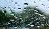
'WHERE'S THE SUN?' You may be seeing this in your windshield and saying that a lot this spring.
Cold, wet Corn Belt and East
The precipitation outlook for early to mid-spring suggests an active pattern for the northern and eastern Plains, Midwest, Great Lakes region, Northeast, New England and the Mid-Atlantic. Late-arriving warmer weather will finally improve crop growth and development.
Prospects for excessive rainfall totals look heightened and may result in periodic flooding centered in Tennessee Valley and parts of the Ohio Valley. Replanting of field may become necessary.
The same pattern holds for the Northeast and New England. Cold air masses, while prevalent in frequency will be short-lived due to the shear lateness of the season. Not until late in the season will the area experience longer-lasting spells of more seasonal temperatures.
As for precipitation, normal to above-normal amounts – even late-season snowfall – are ahead. Fieldwork and planting delays are likely well into the season, along with an increase in spring snowmelt and run-off (flooding) issues.
Keep an eye on the Corn Belt
Across the Midwest and Great Lakes region, southward to the Ohio Valley, saying "it was a far different winter season compared to that of 2012-2013" could be the biggest understatement of the decade. Snowfall totals for the season approached long-standing record, particularly in the eastern and northern Corn Belt.
Severe weather outbreaks will also be on the rise across much of the Midwest and Ohio Valley. Early through mid-spring moisture will raise the specter of low-land flooding, fieldwork and planting delays. Over the remainder of spring, there are signs of a general, ongoing trend of cooler-than-usual conditions, but not necessarily drier.
Signs of El Nino
Looking ahead briefly into the late spring and summer season, there are signs of a "weak" El Nino materializing. It could be a concern due to increased dryness and drought issues in the deep South and Gulf states, along with a limited foray of tropical-oriented systems.
A re-intensification of drought may be possible on the High Plains and the Southwest. "Heat" will likely be focused in the western half of the country. "Cool" will likely dominate the eastern Plains and points eastward, along with potential for an ongoing wet pattern.
Soulje is an agricultural meteorologist writing from Illinois.
You May Also Like
Enter a zip code to see the weather conditions for a different location.


