May 27, 2022

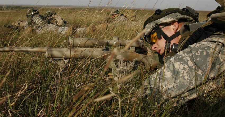
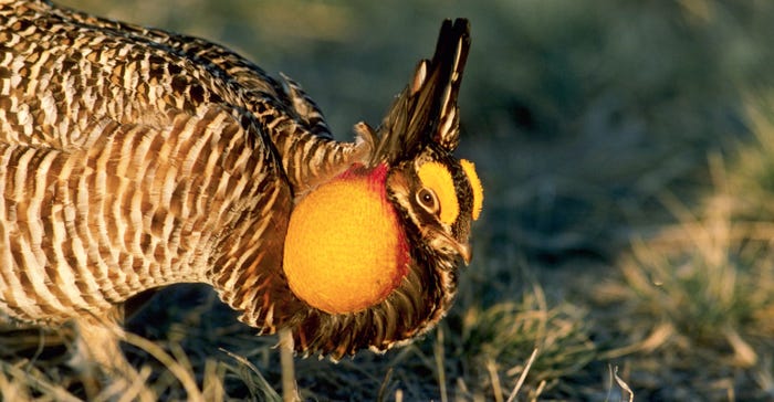
Since 1853, Fort Riley has been an important part of the Flint Hills. One hour west of Topeka, the 5-square-mile Army base is currently home to 15,000 active-duty soldiers and more than 50,000 veterans and civilians. It’s also home to some of the continent’s last best tallgrass prairie, including thriving populations of such grassland birds as greater prairie-chickens.
But this patch of swaying tallgrass prairie — along with the wildlife and military operations it supports — is at risk from a stealthy invader: trees. Woody species like eastern red cedar are taking over prime grasslands across the Great Plains, including in the Flint Hills. Without regular fires to keep seedlings in check, trees have spread beyond their historic Plains habitat into rocky or wet places where flames can’t reach them. Invading woody species diminish forage for livestock, displace grassland birds, increase the risk of wildfires and reduce water supplies.
Defending the fort
Luckily, Fort Riley is still largely free from encroaching trees because the Department of Defense maintains open grasslands here for its infantry training. The DOD has kept trees at bay through prescribed fires or by using machines to cut emerging trees. However, since the base is surrounded by forested areas, the DOD funded a study to determine if there was a way to detect early warning signs — before grasslands begin shifting to woodlands.

Caleb Roberts, a research ecologist with U.S. Geological Survey Arkansas Cooperative Fish and Wildlife Research Unit, led the study. “When one ecosystem changes into a completely different ecosystem, like open prairies becoming forested woodlands, these changes are often very difficult and costly to reverse,” he explains.
Imagine a drop of dye spreading outward across a white paper, Roberts says. If you detect the boundary between dyed and clean paper right away, you have a good chance of estimating how far the dye will move in the following minutes. In the case of Fort Riley, woody plants are the stain and grasslands are clean paper.
“The boundaries are where the action happens. If we can quickly find and track boundaries, we can predict where and when ecosystem shifts will happen in the future,” he says.
Warning system
Roberts and his colleagues used the prairie chickens that live on Fort Riley as a bellwether for woody encroachment. These upland birds avoid trees at all costs, because branches conceal predators. The study compares 23 years of population data from the birds’ mating grounds, called leks, to the change in tree cover over that same period (1994–2017).
“We found greater prairie chicken leks simply did not occur near the edge of woodlands,” Roberts says. “If you look at the maps from our research, it looks like a noose is tightening around Fort’s grasslands. And this didn’t take centuries. It happened in about 25 years.”
Roberts used a free online app called the Rangeland Analysis Platform, which quickly displays changes in vegetation as maps or graphs. With advances in spatial technology from satellite imagery, researchers can now see when, where and how vegetation has changed over time. RAP can be used to visualize how fast trees are encroaching across broad areas like the entire state of Kansas, regional areas like the Army base, or within a single pasture the size of a baseball diamond.
Fighting back
The good news is that new research shows reinstating fire on prairies can reverse woody encroachment. Roberts recently published another paper analyzing bird richness in Nebraska’s Loess Canyons, where landowners have used prescribed burns to reclaim grazing land lost to invading trees. Where fires killed red cedar trees, grassland birds came back — and so did more nutritious forage for ranchers’ livestock.
“You’re going to get more bang for your buck and have longer-lasting results if you chip away at the oncoming woody encroachment, rather than wasting time in areas already heavily infested with trees,” Roberts says. “With earlier warning and better tracking tools, we can work together across properties to push those woody boundaries backward.”
Randall is a writer and communications specialist based in Missoula, Mont.
Source: The USDA Natural Resources Conservation Service Working Lands for Wildlife is solely responsible for the information provided and is wholly owned by the source. Informa Business Media and all its subsidiaries are not responsible for any of the content contained in this information asset.
You May Also Like


