Subscribe to receive top agriculture news
Be informed daily with these free e-newsletters

Root River Partnership shows overwhelming commitment to conservation by farmland owners.
July 6, 2018
The data on saving soil and protecting water quality is clear. Conservation practices work. However, they take time and money, and other priorities can get in the way. The Root River Field to Stream Partnership gathered data, but more importantly, it engaged with growers and encouraged conversations among growers that led to positive changes.
Look at your land for critical problem areas that contribute a disproportionate share of soil/nutrient loss and runoff.
Make resolving the problem a priority.
Seek out cost-share funding and agency expertise to treat the problem.
If funding is not available or avoidance of government involvement is preferred, seek out an experienced practice contractor and self-fund.
Once improvements have been made, share concerns about runoff, siltation or drainage needs with neighbors and look for opportunities to cooperate on solutions.
Be pro-active and act now before excessive soil loss reduces productivity or regulations require it.
---------------
Everybody says they care about conservation, but in three small southeastern Minnesota watersheds, farmers stepped up to the plate to walk the talk. When the Root River Field to Stream Partnership came knocking in 2015, 47 out of 48 farmland owners opened the door. More importantly, they opened their farm gates to the review of their soil and water conservation practices by Ron Meiners, the partnership's technical specialist.
"It was a unique approach, as we called on farmers to share their stewardship goals and asked to walk their land," says Meiners.
One of the larger watersheds in Minnesota, the Root River starts out on glacial till at an elevation of just over 1,000 feet. It empties into the Mississippi River about 80 miles east and nearly 400 feet lower at an elevation of 630 feet. Most of that distance is through a karst region of unglaciated limestone ridges and deep valleys known for spring-fed trout streams. Its deep valleys and steep slopes are known for something else as well. The million-plus-acre watershed is estimated to be the source of 10 to 15% of bed-load sediment discharged into the Mississippi River above Lock and Dam 8 at Genoa, Wisc.
Reducing that sediment loss and improving water quality has been a long-term goal in the area, spanning more than 80 years from the days of the Civilian Conservation Corps to current Soil and Water Conservation Districts' (SWCD) efforts. The Field to Stream Partnership took a different approach. In 2009, the partnership was formed with staff from the Minnesota Department of Agriculture (MDA) and other state agencies, Minnesota Agricultural Water Resources Center, The Nature Conservancy and area SWCDs. Their goal was to better understand how agricultural practices affect water quality at the field and small watershed scale.
"We set out to focus on small watersheds in the larger Root River watershed to answer questions farmers asked about, such as how much actual runoff there was, when it was happening and how effective existing practices were," said Kevin Kuehner, MDA soil scientist and Field to Stream project coordinator. "We didn't have good answers to those questions or what level of practices were needed to meet water quality goals at the watershed scale."
By focusing on small watersheds in strategic locations, the study was more likely to measure changes in water quality. Today, the science-based research combined with the lessons learned can be applied throughout other watersheds in southeast Minnesota.
In Phase I, monitoring equipment was set up at three in-stream sites and five edge-of-field sites in three sub-watersheds of the Root River. In-stream sites capture flow, precipitation, nitrogen, phosphorous, sediment, and turbidity.

Edge-of-field installations like this captured and recorded loss of sediment and nutrients from sample waterways in the Root River Field to Stream Partnership targeted sub-watersheds. Over the seven years of Phase I of the project such sites identified how quickly waterways could fail. This waterway went from a 24 pound per acre soil loss to more than 5,000 pounds per acre in a little over a month, following heavy rains in 2013. An ephemeral gully formed alongside an apparently working waterway.
Edge-of-field stations are positioned on varied slopes from 0-8%. They capture water samples to monitor surface runoff and at one site also measure loss from a sub-surface drainage tile system. Some fields receive injected hog or dairy manure and cropping systems vary from corn and soybean rotations to corn-on-corn and corn and alfalfa rotations. Water samples were analyzed to determine the amount of nitrogen, phosphorus and sediment loss. At non-drain tile sites, sub-surface samples were used to measure nitrate-nitrogen levels in the soil water.
"We took our time to try to do it right. As we gathered local data, we wanted the information to be relevant to their farming systems and allow farmers to see the impact of installing targeted practices.” says Kuehner.

With the data in hand, the Field to Stream Partnership moved to Phase II. The goal of this phase is to enhance and build upon existing conservation practices within the small watersheds. To begin the process farmer leaders and a trusted agronomist sent letters to local farmers explaining the project. Meiners then contacted farmers in the sub-watersheds and began meeting with them in early 2015.
"In most cases, we found only small problems, and all were using a wide range of practices" he says. "There were some sites that needed work, but the land was in better shape than I expected."
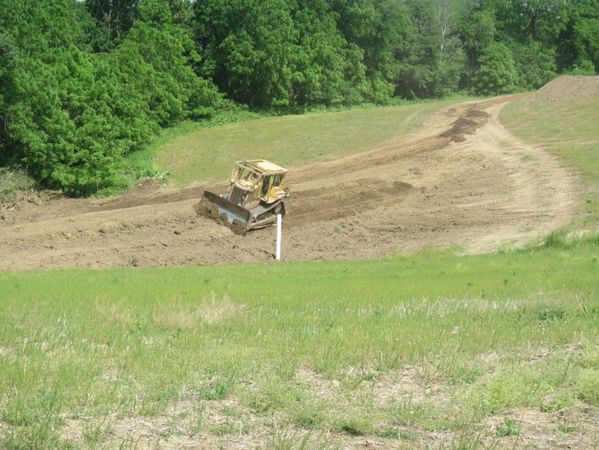
One common problem involved existing waterways that had filled with sediment and were no longer effective. In one 21-acre, edge-of-field site, a waterway failed, even though it looked good from the road. Prior to heavy rains in 2013, it had averaged 24-pounds/acre soil loss over a three-year period. After an ephemeral gully formed to one side, soil losses averaged more than 5,000 pounds/acre, or over five times more loss than what is considered sustainable. When the problem was identified, the landowner fixed it and installed another 6,000 feet of grass waterways on fields with similar issues. “We will continue monitoring the problem waterway and upland practices to measure effectiveness. About a third of the existing waterways that were inventoried in the study’s watersheds were not functioning properly," says Kuehner.
Ironically, the data proved to be of less interest to many landowners Meiners talked with than simply reviewing areas most susceptible to runoff or at higher risk of soil erosion.
"We wanted to target critical source areas and critical time periods on the farm, or those areas and times that contributed a disproportionate amount of sediment and associate nutrient loss," says Kuehner. "Targeting these areas is important since field runoff monitoring over the past seven years found that over 80% of the annual sediment and attached nutrient loss occurred in May and June."
More than 60% of the field walkover participants have already addressed or are in the process of addressing problems that were identified. Kuehner reports that project farmers and partners have installed or renovated more than 65,000 feet of waterways. Thirteen water and sediment control basins have also been installed with more underway, as well as a variety of other practices including dairy wastewater treatment systems, manure storage, rehabilitation of a large flood control structure and cover crops.
While many landowners utilized cost-sharing provided by the Partnership, others moved ahead on their own. Grand Meadow, Minn., grower Ray Cerise and his son Richard got a clean bill of health on their conservation practices, but Meiners pointed out problems upslope and down. Lack of waterways upslope on neighboring fields was dumping silt and water on to their fields. Down slope, a private ditch on a neighbor's land had silted in, causing periodic flooding onto the Cerise land.
"I talked to my neighbors about it, and one up slope landowner put in a grass waterway," says Cerise. "The ditch owner knew he had a problem. I said something has to be done; let's fix it. I offered to clean out the half mile next to my property if he would clear out a half mile upstream. He did, with his neighbor joining in, and this spring we had no problems."
In all three cases, the farmers footed the bill themselves. Long-time corn and soybean grower Sue Dougan was the upslope farmer and neighbored the ditch. She wasn't surprised when the need for a waterway or cleaning out the ditch was identified.
"I knew what was needed," she says. "I think most of us are trying to take care of our land and most of us know what we need to do, but getting the crops in and taking them out takes priority. Often there isn't much time available before planting or after harvest to get things done."
Dougan admits that having her high runoff risk areas pointed out by Meiners and talking with Cerise probably moved them up in priority. Meiners credits farmers talking with their neighbors as the prime driver in the Partnership's success.
"If the neighbor was putting in a waterway or a pond, they did too," he says. "They liked the concept of showing the public that landowners are willing to step up and make changes without enforcement. They know rules and regulations are coming. If they can show they acted before, that's a big deal."
Check out these two videos about the project:
You May Also Like
Enter a zip code to see the weather conditions for a different location.


