Subscribe to receive top agriculture news
Be informed daily with these free e-newsletters

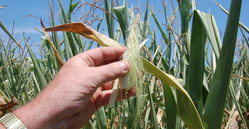
Some farmers are looking at the big picture with satellites and fine-tuning with drones.
December 6, 2018
By Jessica Merzdorf
Indiana farmers are confronting climate change, and some are turning to a big-picture solution to help see what’s happening to their fields and to prepare for the future. They’re looking at data from satellites.
Scientists at Purdue University already see signs of climate change in Indiana. The Indiana Climate Change Impacts Assessment is a group of more than 100 scientists and professionals across Purdue Extension, public and environmental health departments, natural resources departments, state and local government and universities. The group released a report in July demonstrating that Indiana is already getting warmer, damaging corn yields now and threatening livestock, fruit trees, vine crops and soil in the future.
The good news is that Hoosiers are already adapting to climate change in innovative ways. Some Hoosiers are looking toward the stars for tools to help them adapt: satellites.
Satellites track big picture
By using satellite-based geographic information system technology, today’s farmers can combine many types of data into a comprehensive “picture” of their farm. Indiana’s climate is changing slowly over years and even decades.
Farmers can use historical data to see how conditions are different today. Logging this information now will give them a “yardstick” against which to measure future climate trends.
NASA satellites like Landsat have gathered information about Earth since the 1960s. When GPS technology became available, farmers could link data to location, allowing them to create maps of yield, moisture, temperature and other variables.
Rick Beach uses satellite images and data to keep his farm cost-effective and environmentally sustainable. In his work as a permaculture consultant and on his own small farm near Greencastle, Ind., Beach imports GIS data from Indiana University’s Indiana Spatial Data Portal into Google Earth Pro to map his property’s topography and water sources. By knowing his land’s curves and hills, Beach can more accurately measure fence, partition land for grazing and assess damage after droughts or floods.
“I used to print maps on transparencies and overlay them,” Beach says. “Now, I can see 20- to 30-foot increments and get the whole picture. If I have my springs mapped there, if I’m mapping my fencing, it’s much better.”
Google Earth Pro is now available for free, Beach adds.
Information layers
Google Earth and Google Earth Pro can measure altitude, distance and area, allowing farmers to better understand the layout of their land. The professional version allows users to import a variety of data types to create interactive, multiple-layer maps. These tools are based on traditional images captured using normal cameras.
Other satellite-based tools such as USDA’s Crop Explorer yield information about crop health, soil moisture and soil temperature, giving a more complete picture of how crops are doing now and predicting their status in the near future. They collect data from outside the visible range of light, including ultraviolet and other frequencies.
“Satellite data gives you a general idea of the conditions in the area,” says Iliana Mladenova, a research scientist at NASA’s Goddard Space Flight Center in Greenbelt, Md. “The satellite observations will tell you how much water is available [in the soil] for plant growth before and during the growing season, and how these conditions are different compared to last year, so the farmer knows whether the moisture conditions are optimal for plant growth and development. This allows him to plan irrigation and cropping activities.”
Future uses
The Indiana Climate Change Impacts Assessment predicts that Indiana’s hydrology will change significantly as warmer temperatures bring precipitation changes and flooding, making it crucial that farmers can monitor and predict soil moisture.
Users can download data from Crop Explorer and CropScape, a census-based tool that maps land use and ground cover using data from satellites, the USDA National Agricultural Statistics Service and farmers’ reports. They can import these data products into Google Earth Engine and other platforms that can analyze ground conditions at specific geographic locations over time.
Many online tools such as Google Earth Engine may require some technical skill, Mladenova cautions. Applications like Crop Explorer make the process simpler, but still require some technological expertise.
Satellites vs. drones
Some farmers choose to turn to drone technology instead of satellites. Drones also give farmers a bigger-picture look. Mladenova says satellite data offers perks that drone data doesn’t.
“You can fly a drone a few times during a season, but satellites give us a consistent and reliable observation every day,” Mladenova says. “It doesn’t just rain over a small area — the impact is much larger. Satellite data will give you the general idea of whether moisture conditions are low or normal.”
Incorporating satellite data into predictive models allows scientists to understand and predict “moisture conditions and changes, and the impact of these changes on crop health and potential end-of-season yield,” she adds.
Drones offer advantages in some situations, Mladenova says. Images they capture are higher-resolution, making them useful for looking at smaller areas like fields.
“Some satellites can provide data to a few kilometers,” Mladenova says. “If you’re looking at a field in the Midwest, that’s not always an optimal resolution. Once you use a drone, you can get down to centimeters.”
Prepare for future
Mladenova predicts that the next few years will see even more users relying on satellite data to make decisions about land use. Access to historical data can help scientists and farmers better understand what might happen in the future.
Back in Greencastle, Beach says preparing for climate change is one part of his family’s larger plan to stay ecologically and financially sustainable for many years. Through diversification, planting trees and using species native to Indiana, they hope to protect their farm against extreme weather events, droughts, floods and shifting temperatures.
“Using data, you have to look at the various climate change scenarios and find the worst-case scenario,” Beach says. “You have to plan for what could happen.”
Merzdorf is a graduate student in ag sciences and education at Purdue University. She writes from West Lafayette, Ind.
You May Also Like
Enter a zip code to see the weather conditions for a different location.


