More than a decade ago, a county Extension educator visited a 40-acre cornfield during the grain fill period. The farmer had noticed a peculiar pattern after walking several rows into the field and wanted help figuring out the cause. Every so often, two side-by-side rows were pale green to yellow in color, while other rows were still dark green.
The Extension educator visited the field, used a kit designed to test nitrogen levels and determined that the rows with greener leaves were higher in nitrogen content. That simply confirmed what he had suspected. But walking through the field in August, he couldn’t pinpoint a pattern in the field. He didn’t have the right perspective.
“If only I could get a shot above the field from the air,” the agent thought to himself. But unmanned aerial vehicles were just coming on the scene, and the Federal Aviation Administration hadn’t set rules for their use. The educator didn’t have access to a UAV. So, he was left speculating, and never knew for sure why scattered pairs of rows were pale green and lower in nitrogen.
“We certainly have the capability to help someone detect patterns from the air today,” says Bryan Overstreet, an Extension educator in Jasper County, Ind., and a certified crop adviser.
Overstreet flew 3,000 acres of crop fields for farmers in 2018, plus more fields this year. He’s one of about 18 educators in Indiana with access to a DJI Phantom 4 Pro quadcopter, thanks to a pilot program through Purdue University Extension. Ag retailers and others across the Corn Belt now often include aerial scouting as a service they offer customers.
Until recently, the concept was to use a drone to identify spots within a field that needed further inspection, and then use GPS to walk to the spot. That would allow you to see what was wrong at that location. It’s still a sound concept and helps solve more complicated situations, Overstreet says.
Classic example
In some cases, thanks to advancements in drones, you may be able to identify the problem from the air, before walking to the actual spot.
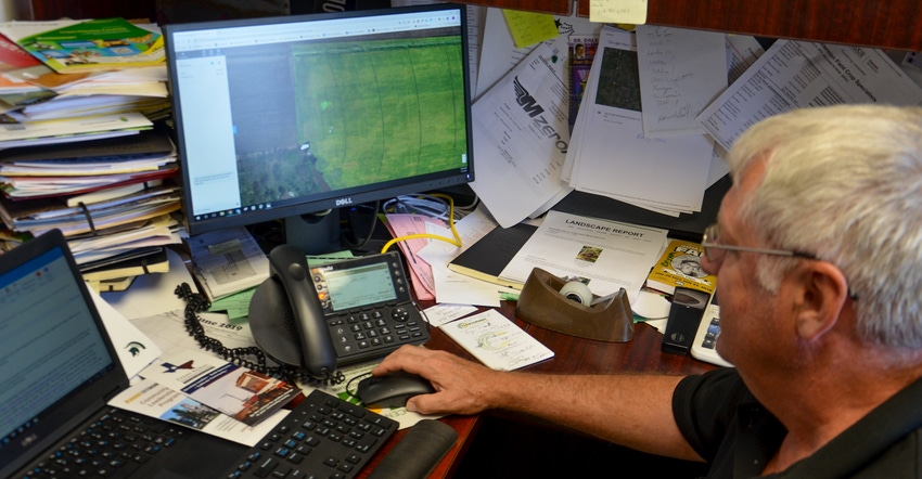
“I flew a soybean field in late summer last year and was watching the image on the screen,” Overstreet says. He earned his FAA UAV pilot license and is now preparing to teach courses to help farmers earn their own licenses.
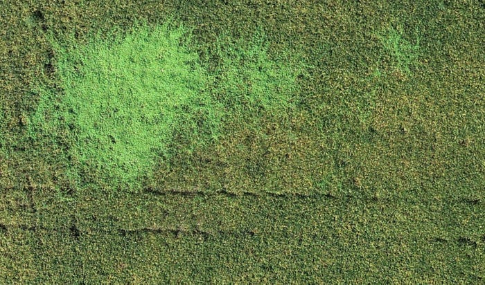
“This light green, blotchy spot stood out in one corner of the field,” he continues. “I wasn’t sure at first what it was, but I suspected it might be a weed problem. I manually flew at a lower height to get a better look.”
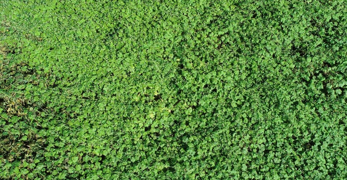
Zooming in on the image, he determined the spot was indeed a patch of weeds. Not only that, but he was also able to get an image good enough to determine it was a vine, burr cucumber. He later confirmed this by walking to the spot, but he was confident of his conclusion before he physically entered the field.

LOW-ALTITUDE VIEWPOINT: From this height, the lighter green vegetation begins coming into focus. You can see a sprayer track through the field near the top of the photo.


ZERO IN ON PATCH: The distinctive leaf shape of burr cucumber becomes visible in this zoomed-in aerial image, Bryan Overstreet says.

“That’s how useful these tools are today,” Overstreet says. “I use a service called DroneDeploy, which requires a subscription fee, but which delivers stitched images in a short time period. If I wanted to, I could make a very accurate image of a field with a spot like that using that service.”
Future uses
Some companies are promising software that will make stand counts of corn from the air. Sentera introduced software in 2018 that could identify patches of weeds in a crop field from a routine drone flight, although it couldn’t differentiate which type of weed. However, spokespeople promise that technology is coming soon.
Just recently, Rantizo obtained licenses in Iowa and Wisconsin to apply agrichemicals with a drone. Spokespeople for Rantizo note that they developed the technology months ago. The hard part was getting approval to use it commercially.
Others envision seeding cover crops from the air. For his part, Overstreet continues seeking out new uses. He will be flying over the local high school football field after games this fall. The football coach and grounds crew use the information to study wear patterns on the field. It helps them determine how to manage the turf better.
About the Author(s)
You May Also Like


